
| - People - |
Minorities
The Chinese population of more than one billion consists of a great many ethnic national minorities. These ethnic groups are as diverse as they are unique; each one contributing its own drop in the river of Chinese culture and history. Of the countless hundreds of minorities within the greater China region, these are the 56 most populous.
This page contains Chinese characters. Please see here for information regarding how to read Chinese on your computer.
Contents
SEE Also:
Achang (Chinese: 阿昌族; Pinyin: Āchāng Zú)
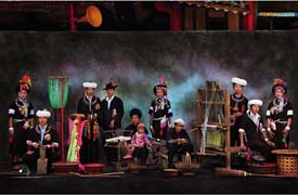
More than 90 percent of the 27,700 Achangs live in Longchuan, Lianghe and Luxi counties in the Dehong Dai-Jingpo Autonomous Prefecture in southwestern Yunnan Province. The rest live in Longling County in the neighboring Baoshan Prefecture.
These areas are on the southern tip of the Gaoligong Mountains. The climate is warm; the land fertile, crisscrossed by the Daying and Longchuan rivers and their numerous tributaries. The river valleys contain many plains, the Fusa and Lasa being the largest of them. Dense forests populated by deer, musk deer and bears cover the mountain slopes. Natural resources, such as coal, iron, copper, lead, mica and graphite, abound.
Achangs speak a language belonging to the Tibetan-Myanmese language family of the Chinese-Tibetan system. Most Achangs also can speak Chinese and the language of Dais. Their written language is Chinese.
Bai (Chinese: 白族; Pinyin: Bái Zú)
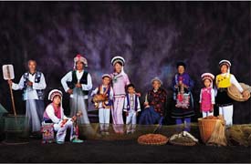
Of the 1,598,100 Bai people, 80 per cent live in concentrated communities in the Dali Bai Autonomous Prefecture in Yunnan Province, southwest China. The rest are scattered in Xichang and Bijie in neighboring Sichuan and Guizhou provinces respectively.
The Bais speak a language related to the Yi branch of the Tibetan-Myanmese roup of the Chinese-Tibetan language family. The language contains a large number of Chinese words due to the Bais' long contact with the majority Chinese ethnic group--Han.
Situated on the Yunnan-Guizhou Plateau, the Bai area is crisscrossed with rivers, of which the major ones are the Lancang, the Nujiang and the Jinsha. The river valleys, dense forests and vast tracts of land form a beautiful landscape and provide an abundance of crops and fruits. The area round Lake Erhai in the autonomous prefecture is blessed with a mild climate and fertile land yielding two crops a year. Here, the main crops are rice, winter wheat, beans, millet, cotton, rape, sugar-cane and tobacco. The forests have valuable stocks of timber, herbs of medicinal value and rare animals. Mt. Diancang by Lake Erhai contains a rich deposit of the famous Yunnan marble, which is basically pure white with veins of red, light blue, green and milky yellow. It is treasured as building material as well as for carving.
Blang (Chinese: 布朗族; Pinyin: Bùlǎng Zú)
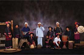
The Blang people, numbering 82,400, live mainly in Mt. Blang, Xiding and Bada areas of Menghai County in the Xishuangbanna Dai Autonomous Prefecture in southwestern Yunnan Province. There are also scattered Blang communities in the neighboring Lincang and Simao prefectures. All the Blangs inhabit mountainous areas 1,500-2,000 meters above sea level. The Blangs in Xishuangbanna have always lived harmoniously with their neighbors of both the other minority nationalities and the majority Han.
The Blang people inhabit an area with a warm climate, plentiful rainfall, fertile soil and rich natural resources. The main cash crops are cotton, sugar-cane and the world famous Pu'er tea. In the dense virgin forests grow various valuable trees, and valued medicinal herbs such as pseudoginseng, rauwolfia verticillata (used for lowering high blood pressure) and lemongrass, from which a high-grade fragrance can be extracted. The area abounds in copper, iron, sulfur and rock crystal.
The Blangs speak a language belonging to the South Asian language family. The language does not have a written form, but Blangs often know the Dai, Va and Han languages.
According to historical records, an ancient tribe called the "Pu" were the earliest inhabitants of the Lancang and Nujiang river valleys. These people may have been the ancestors of today's Blangs.
Bonan (Chinese: 保安族; Pinyin: Bǎoān Zú)
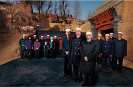
The Bonan is one of China's smallest ethnic minorities, with only 11,700 people. Its language belongs to the Mongolian branch of the Altaic language family and is close to that of the Tu and Dongxiang ethnic minorities. Due to long years of contacts and exchanges with the neighboring Han and Hui people, the Bonan people have borrowed quite a number of words from the Han language. The Han language is accepted as the common written language among the Bonans.
Judging from their legends, language features and customs, many of which were identical with those of the Mongolians, the Bonan minority seems to have taken shape after many years of interchanges during the Yuan and Ming (1271- 1644) periods between Islamic Mongolians who settled down as garrison troops in Qinghai's Tongren County, and the neighboring Hui, Han, Tibetan and Tu people. The Bonans used to live in three major villages in the Baoan region, situated along the banks of the Longwu River within the boundaries of Tongren County.
During the early years of the reign of Qing Emperor Tongzhi (1862- 1874), they fled from the oppression of the feudal serf owners of the local Lamaist Longwu Monastery. After staying for a few years in Xunhua, they moved on into Gansu Province and finally settled down at the foot of Jishi Mountain in Dahejia and Liuji, Linxia County. Incidentally, they again formed themselves into three villages -- Dadun, Ganmei and Gaoli -- which they referred to as the "tripartite village of Baoan" in remembrance of their roots.
Buyei (Chinese: 布依族; Pinyin: Bùyī Zú)
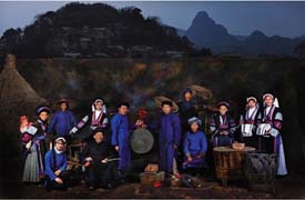
Most of China's 2,548,300 Bouyei people live in several Bouyei-Miao autonomous counties in Xingyi and Anshun prefectures and Qiannan Bouyei-Miao Autonomous Prefecture in Guizhou Province. Others are distributed in counties in the Qiandongnan Miao-Dong Autonomous Prefecture or near Guiyang, the capital of Guizhou.
The Bouyei region is on the Yunnan-Guizhou Plateau, which slopes from an altitude of 1,000 meters in the north to 400 meters in the south. The Miaoling Mountains stretch across the plateau, forming part of its striking landscape.
The famous Huangguoshu Falls cascade down more than 60 meters near the Yunnan-Guizhou highway in Zhenning Bouyei-Miao Autonomous County. The thunder of water can be heard several kilometers away, and mists from the falls contribute to a magnificent view.
The Bouyeis are blessed with fertile land and a mild climate. The average annual temperature is 16 degrees Centigrade, and an essentially tropical environment, receiving between 100 and 140 centimeters of rain a year, is ideal for farming. Local crops include paddy rice, wheat, maize, dry rice, millet, sorghum, buckwheat, potatoes and beans. Farmers also grow cotton, ramie, tobacco, sugar cane, tung oil, tea and oil-tea camellia as profitable cash crops.
As the Red River valley is low-lying and tropical, paddy rice yields two harvests annually. Silk, hemp, bamboo shoots and bananas complement the local economy, and coffee and cocoa have also been planted there recently.
Dai (Chinese: 傣族; Pinyin: Dǎi Zú)
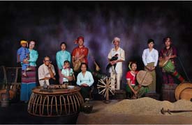
Also called Dai Lue, one of the Tai ethnic groups, the Dai ethnic group lives in the southern part of Yunnan Province, mainly in the Xishuangbanna region. The area is subtropical, with plentiful rainfall and fertile land.
Local products include rice, sugar cane, coffee, hemp, rubber, camphor and a wide variety of fruits. Xishuangbanna is the home of China's famous Pu'er tea. The dense forests produce large amounts of teak, sandalwood and medicinal plants, and are home to wild animals including elephants, tigers and peacocks.
The Dai language belongs to the Chinese-Tibetan language family and has three major dialects. It is written in an alphabetic script.
Daur (Chinese: 达斡尔族; Pinyin: Dáwòěr Zú)
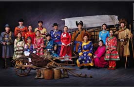
The Daurs live mainly in the Inner Mongolia Autonomous Region and Heilongjiang Province. About several thousand of them are found in the Tacheng area in the Xinjiang Uygur Autonomous Region in northwest China. They are descendents of Daurs who moved to China's western region in the early Qing Dynasty (1644-1911). The Daurs speak a language related to Mongolian and used Manchu during the Qing Dynasty as their written language. Since the 1911 Revolution, mandarin Chinese has replaced Manchu.
The biggest Daur community is in the Morin Dawa Daur Autonomous Banner, which was set up on August 15, 1958 on the left bank of the Nenjiang River in Heilongjiang Province. This 11,943 sq. km.-area has lush pasture and farmland. The main crops are maize, sorghum, wheat, soybeans and rice. In the mountains which border the Daur community on the north are stands of valuable timber, such as oak, birch and elm and medicinal herbs. Wildlife, including bears, deer, lynx and otters are found in the forests. Mineral deposits in the area include gold, mica, iron and coal.
De'ang (Chinese: 德昂族; Pinyin: Déáng Zú)
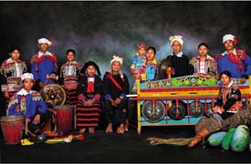
The number of De'ang people in China totals 15,500. Small as their population is, the people of this ethnic group are quite widely distributed over Yunnan Province. Most of them dwell in Santai Township in Luxi County of the Dehong Dai-Jingpo Autonomous Prefecture and in Junnong Township in Zhenkang County of the Lincang Prefecture. The others live scattered in Yingjiang, Ruili, Longchuan, Baoshan, Lianghe and Gengma counties. Some De'angs live together with the Jingpo, Han, Lisu and Va nationalities in the mountainous areas. And a small number of them have their homes in villages on flatland peopled by the Dais The De'ang language belongs to the South Asian family of languages. The De'angs have no written script of their own, and many of them have learned to speak the Dai, Han or Jingpo languages, and some can read and write in the Dai language. An increasing number of them have picked up the Han language in years after the mid-20th century.
Derung (Chinese: 独龙族; Pinyin: Dúlóng Zú)
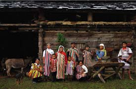
The Derungs, numbering about 4,700, live mainly in the Dulong River valley of the Gongshan Drung and Nu Autonomous County in northwestern Yunnan Province. Their language belongs to the Tibetan-Myanmese group of the Chinese-Tibetan language family. Similar to the language of the Nu people, their neighbors, it does not have a written form and, traditionally, records were made and messages transmitted by engraving notches in wood and tying knots.
During the Tang Dynasty (618-907), the places where the Drungs lived were under the jurisdiction of the Nanzhao and Dali principalities. From the Yuan Dynasty (1271-1368) to the end of the Qing Dynasty (1644-1911), the Drungs were ruled by court-appointed Naxi headmen. In modern times, the ethnic minority distinguished itself by repulsing a British military expedition in 1913.
Dong (Chinese: 侗族; Pinyin: Dòng Zú)
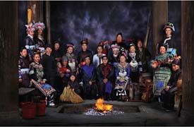
Nestling among the tree-clad hills dotting an extensive stretch of territory on the Hunan-Guizhou-Guangxi borders are innumerable villages in which dwell the Dong people.
The population of this ethnic group in China is 2.5 million. Situated no more than 300 km north of the Tropic of Cancer, the area peopled by the Dongs has a mild climate and an annual rainfall of 1,200 mm. The Dong people grow enormous numbers of timber trees which are logged and sent to markets. Tong-oil and lacquer and oil-tea camellia trees are also grown for their edible oil and varnish.
The most favorite tree of the people of this ethnic group is fir, which is grown very extensively. Whenever a child is born, the parents begin to plant some fir saplings for their baby. When the child reaches the age of 18 and marries, the fir trees, that have matured too, are felled and used to build houses for the bride and groom. For this reason, such fir trees are called "18-year-trees." With the introduction of scientific cultivation methods, a fir sapling can now mature in only eight or 10 years, but the term "18-year-trees" is still current among the Dong people.
Farming is another major occupation of the Dongs, who grow rice, wheat, millet, maize and sweet potatoes. Their most important cash crops are cotton, tobacco, rape and soybean.
With no written script of their own before 1949, many Dongs learned to read and write in Chinese. Philologists sent by the central government helped work out a Dong written language on the basis of Latin alphabet in 1958.
Dongxiang (Chinese: 东乡族; Pinyin: Dōngxiāng Zú)

People of the Dongxiang ethnic minority live in the part of the Linxia Hui Autonomous Prefecture situated south of the Yellow River and southwest of Lanzhou, capital city of the northwest province of Gansu. Half of them dwell in the Dongxiang Autonomous County, and the rest are scattered in Hezheng and Linxia counties, the city of Lanzhou, the Xinjiang Uygur Autonomous Region and some other places.
The Dongxiang ethnic minority received its name from the place it lives -- Dongxiang. However, this ethnic group was not recognized as a minority prior to the founding of the People's Republic in 1949. The Dongxiangs were then called "Dongxiang Huis" or "Mongolian Huis." The Dongxiang language is basically similar to Mongolian, both belonging to the Mongolian branch of the Altaic language family. It contains quite a number of words borrowed from the Han Chinese language. Most of the Dongxiang people also speak Chinese, which is accepted as their common written language. Quite a few of them can use the Arabic alphabet to spell out and write Dongxiang or Chinese words.
The Dongxiangs are an agricultural people who grow potatoes, wheat, maize and broad beans as well as hemp, rapeseed and other industrial crops.
Ewenki (Chinese: 鄂温克族; Pinyin: Èwēnkè Zú)
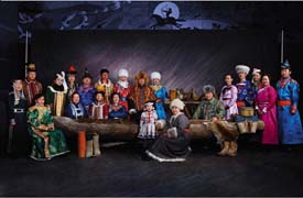
This ethnic minority is distributed across seven banners (counties) in the Inner Mongolia Autonomous Region and in Nahe County of Heilongjiang Province, where they live together with Mongolians, Daurs, Hans and Oroqens.
The Ewenki people have no written script but a spoken language composed of three dialects belonging to the Manchu-Tungusic group of the Altai language family. Mongolian is spoken in the pastoral areas while the Han language is used in agricultural regions. The Ewenki Autonomous Banner, nestled in the ranges of the Greater Hinggan Mountains, is where the Ewenkis live in compact communities. A total of 19,110 square kilometers in area, it is studded with more than 600 small and big lakes and 11 springs. The pastureland here totaling 9,200 square kilometers is watered by the Yimin and four other rivers, all rising in the Greater Hinggan Mountains.
Nantunzhen, the seat of the banner government, is a rising city on the grassland. A communication hub, it is the political, economic and cultural center of the Ewenki Autonomous Banner.
Large numbers of livestock and great quantities of knitting wool, milk, wool-tops and casings are produced in the banner. Some 20-odd of these products are exported. The yellow oxen bred on the grassland have won a name for themselves in Southeast Asian countries. Pelts of a score or so of fur-bearing animals are also produced locally.
Reeds are in riot growth and in great abundance along the Huihe River in the banner. Some 35,000 tons are used annually for making paper. Lying beneath the grassland are rich deposits of coal, iron, gold, copper and rock crystal.
Gaoshan (Chinese: 高山族; Pinyin: Gāoshān Zú)
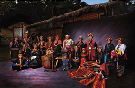
The Gaoshan people, about 300,000 in total, live mainly in Taiwan. They account for less than 2 per cent of the 17 million inhabitants, based on statistics published by Taiwan authorities in June 1982. The majority of them live in mountain areas and the flat valleys running along the east coast of Taiwan Island, and on the Isle of Lanyu. About 1,500 live in such major cities as Shanghai, Beijing and Wuhan and in Fujian Province on the mainland.
The Gaoshans do not have their own script, and their spoken language belongs to the Indonesian group of the Malay/Polynesian language family.
Taiwan Island, home to the Gaoshans, is subtropical in climate with abundant precipitation and fertile land yielding two rice crops a year (three in the far south). Being one of China's major sugar producers, Taiwan also grows some 80 kinds of fruit, including banana, pineapple, papaya, coconut, orange, tangerine, longan and areca. Taiwan's oolong and black teas are among its most popular items for export.
The Taiwan Mountain Range runs from north to south through the eastern part of the island, which is 55 per cent forested. Over 70 per cent of the world's camphor comes from Taiwan. Short and rapid rivers flowing from the mountains provide abundant hydropower, and the island is blessed with rich reserves of gold, silver, copper, coal, oil, natural gas and sulfur. Salt is a major product of the southeast coast, and the offshore waters are ideal fishing grounds.
The Gaoshans are mainly farmers growing rice, millet, taro and sweet potatoes. Those who live in mixed communities with Han people on the plains work the land in much the same way as their Han neighbors. For those in the mountains, hunting is more important, while fishing is essential to those living along the coast and on small islands.
Gaoshan traditions make women responsible for ploughing, transplanting, harvesting, spinning, weaving, and raising livestock and poultry. Men's duties include land reclamation, construction of irrigation ditches, hunting, lumbering and building houses.
Flatland inhabitants entered feudal society at about the same time as their Han neighbors. Private land ownership, land rental, hired labor and the division between landlords and peasants had long emerged among these Gaoshans. But, in Bunong and Taiya, land was owned by primitive village communes. Farm tools, cattle, houses and small plots of paddy field were privately owned. A primitive cooperative structure operated in farming and the bag of collective hunting was distributed equally among the hunters with an extra share each to the shooter and the owner of the hound that helped.
Twenty-nine hundred Gaoshans now live on the mainland. Though small in number, these Gaoshans have their deputies to the National People's Congress, China's supreme organ of power.
Gelao (Chinese: 仡佬族; Pinyin: Gēlǎo Zú)

The 438,200 Gelos live in dispersed clusters of communities in about 20 counties in western Guizhou Province, four counties of the Wenshan Zhuang-Miao Autonomous Prefecture in southeastern Yunnan Province and the Longlin Multi-ethnic Autonomous County in Guangxi Zhuang Autonomous Region.
Only about a quarter of the Gelos still speak the Gelo language belonging to the Chinese-Tibetan language family. Yet, because of close contact with other ethnic groups, their language has not remained pure -- even within counties. There are Gelo-speaking people unable to converse with each other. For this reason, the language of the Hans, or Chinese, has become their common language, though many Gelos have learned three or four languages from other people in their communities, including the Miaos, Yis and Bouyeis. Living among other ethnic groups, the Gelos have become largely assimilated to the majority Han customs.
Han (Chinese: 汉族; Pinyin: Hàn Zú)
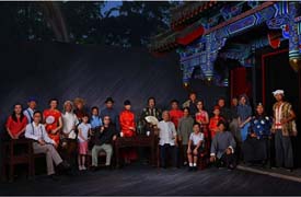
The Han are the majority ethnic group within China and the largest single human ethnic group in the world. The Han Chinese constitute about 92 percent of the population of mainland China and about 19 percent of the entire global human population. The name was occasionally translated as the "Chinese proper" in older texts (pre-1980s) and is commonly rendered in Western media as the "ethnic Chinese."
The term "Han Chinese" is used to distinguish the majority from the various minorities in and around China. The name comes from the Han Dynasty which succeeded the short-lived Qin Dynasty that reunited China. The Zhou dynasty, which preceded the Qin, was a period of consolidation when the various tribes coalesced into Warring States, which then annexed each other. It was during the Qin Dynasty and the Han Dynasty that the various tribes of China began to feel that they belonged to the same ethnic group, compared with "barbarians" around them. In addition, the Han Dynasty is considered a high point in Chinese civilization, able to project its power far into Central Asia.
Even today many Chinese people call themselves "Han persons" (Hànrén). The term Han Chinese is sometimes used synonymously with "Chinese" without regard to the 55 other minority Chinese ethnic groups; usage of this kind tends to be frowned upon by Chinese nationals, who regard the phrase Zhongguó rén (中國人) to be a more precise terminology.
Amongst Southern Chinese, a different term exists within various languages like Cantonese, Hakka and Minnan, but which means essentially the same thing. The term is Tángrén (唐人, literally "the people of Tang"). This also derives from another Chinese dynasty, the Tang dynasty, which is regarded as another zenith of Chinese civilization. In fact, the term survives in most Chinese references to Chinatown, known as 唐人街 ("Street of Tang People").
In Southeast Asia, another term used commonly by overseas Chinese is Huaren (Simplified Chinese: 华人; Traditional Chinese: 華人; Hanyu Pinyin: huárén), derived from Zhonghua (中华), a literary name for China. The usual translation is "ethnic Chinese". Sometimes the term is restricted to refer to only those Chinese who are overseas (outside Greater China).
Hani (Chinese: 哈尼族; Pinyin: Hāní Zú)
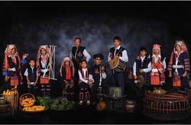
Most of the 1,254,800 Hanis live in the valleys between the Yuanjiang and Lancang rivers, that is, the vast area between the Ailao and Mengle mountains in southern Yunnan Province. They are under the jurisdiction of the Honghe Hani-Yi Autonomous Prefecture, which includes Honghe, Yuanyang, Luchun and Jinping counties. Others dwell in Mojiang, Jiangcheng, Pu'er, Lancang and Zhenyuan counties in Simao Prefecture; in Xishuangbanna's Menghai, Jinghong and Mengla counties; in Yuanjiang and Xinping, Yuxi Prefecture, and (a small number) in Eshan, Jianshui, Jingdong and Jinggu counties.
Their language belongs to the Yi branch of the Tibetan-Myanmese language group of the Chinese-Tibetan language family. Having no script of their own before 1949, they kept records by carving notches on sticks. In 1957 the people's government helped them to create a script based on the Roman alphabet.
The areas inhabited by the Hanis have rich natural resources. Beneath the ground are deposits of tin, copper, iron, nickel and other minerals. Growing on the rolling Ailao Mountains are pine, cypress, palm, tung oil and camphor trees, and the forests abound in animals such as tigers, leopards, bears, monkeys, peacocks, parrots and pheasants. Being subtropical, the land is fertile and the rainfall plentiful -- ideal for growing rice, millet, cotton, peanuts, indigo and tea. Xishuangbanna's Nanru Hills are one of the country's major producers of the famous Pu'er tea.
Hezhe (Chinese: 赫哲族; Pinyin: Hèzhé Zú)
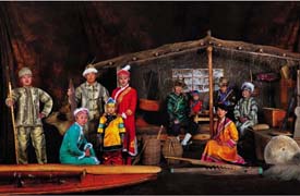
The Hezhes are one of the smallest ethnic minority groups in China. In fact, poverty and oppression had reduced their numbers to a mere 300 at the time of the founding of the People's Republic of China in 1949. Since then, however, they have made speedy advances in their economic life and health care, so that by 1990 the population had grown to 4,300.
They are a nomadic people who live mainly by hunting and fishing in the plain formed by the Heilong, Songhua and Wusuli rivers in Tongjiang, Fuyuan and Raohe counties in northeast China's Heilongjiang Province. Their language, which belongs to the Manchu-Tungusic group of the Altaic family, has no written form. For communication with outsiders they use the spoken and written Chinese language.
In winter they travel by sled and hunt on skis. They are also skilled at carpentry, tanning and iron smelting; but these are still cottage industries.
Traditional Hezhe clothing is made of fish skins and deer hides. The decorations of the clothes consist of buttons made of catfish bones and collars and cuffs dyed in cloud-shaped patterns. Women wear fish-skin and deer-hide dresses decorated with shells and colored strips of dyed deer hide in cloud, plant and animal designs. Bear skins and birch bark are also used to make thick boots which everyone wears in winter.
Hui (Chinese: 回族; Pinyin: Huí Zú)
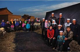
With a sizable population of 8.61 million, the Hui ethnic group is one of China's largest ethnic minorities. People of Hui origin can be found in most of the counties and cities throughout the country, especially in the Ningxia Hui Autonomous Region and Gansu, Qinghai, Henan, Hebei, Shandong and Yunnan provinces and the Xinjiang Uygur Autonomous Region.
The name Hui is an abbreviation for "Huihui," which first appeared in the literature of the Northern Song Dynasty (960- 1127). It referred to the Huihe people (the Ouigurs) who lived in Anxi in the present-day Xinjiang and its vicinity since the Tang Dynasty (618- 907). They were actually forerunners of the present-day Uygurs, who are totally different from today's Huis or Huihuis.
During the early years of the 13th century when Mongolian troops were making their western expeditions, group after group of Islamic-oriented people from Middle Asia, as well as Persians and Arabs, either were forced to move or voluntarily migrated into China. As artisans, tradesmen, scholars, officials and religious leaders, they spread to many parts of the country and settled down mainly to livestock breeding. These people, who were also called Huis or Huihuis because their religious beliefs were identical with people in Anxi, were part of the ancestors to today's Huis.
Earlier, about the middle of the 7th century, Islamic Arabs and Persians came to China to trade and later some became permanent residents of such cities as Guangzhou, Quanzhou, Hangzhou, Yangzhou and Chang'an (today's Xi'an). These people, referred to as "fanke" (guests from outlying regions), built mosques and public cemeteries for themselves. Some married and had children who came to be known as "tusheng fanke," meaning "native-born guests from outlying regions." During the Yuan Dynasty (1271- 1368), these people became part of the Huihuis, who were coming in great numbers to China from Middle Asia.
The Huihuis of today are therefore an ethnic group that finds its origins mainly with the above-mentioned two categories, which in the course of development took in people from a number of other ethnic groups including the Hans, Mongolians and Uygurs.
It is generally acknowledged that Huihui culture began mainly during the Yuan Dynasty.
Jing (Chinese: 景族; Pinyin: Jǐng Zú)

The 18,700 people of this very small ethnic minority live in compact communities primarily in the three islands of Wanwei, Wutou and Shanxin in the Fangcheng Multi-ethnic Autonomous County, the Guangxi Zhuang Autonomous Region, near the Sino-Vietnamese border. About one quarter of them live among the Han and Zhuang ethnic groups in nearby counties and towns.
The Jings live in a subtropical area with plenty of rainfall and rich mineral resources. The Beibu Gulf to its south is an ideal fishing ground. Of the more than 700 species of fish found there, over 200 are of great economic value and high yields. Pearls, sea horses and sea otters which grow in abundance are prized for their medicinal value. Seawater from the Beibu Gulf is good for salt making. The main crops there are rice, sweet potato, peanut, taro and millet, and sub-tropical fruits like papaya, banana and longan are also plentiful. Mineral deposits include iron, monazite, titanium, magnetite and silica. The large tracts of mangroves growing in marshy land along the coast are a rich source of tannin, an essential raw material for the tanning industry.
The Jing people had their own script which was called Zinan. Created on the basis of the script of the Han people towards the end of the 13th century, it was found in old song books and religious scriptures. Most Jings read and write in the Han script because they have lived with Hans for a long time. They speak the Cantonese dialect.
The ancestors of the Jings emigrated from Viet Nam to China in the early 16th century and first settled on the three uninhabited lands since the neighborhood had been populated by people of Han and Zhuang ethnic group. Shoulder to shoulder with the Hans and Zhuangs there, they developed the border areas together and sealed close relations in their joint endeavors over the centuries.
Jingpo (Chinese: 景颇族; Pinyin: Jǐngpō Zú)
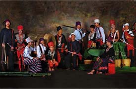
The Jingpos, numbering 119,300, live mostly in the Dehong Dai-Jingpo Autonomous Prefecture, Yunnan Province, together with the De'ang, Lisu, Achang and Han peoples. A few of them are found in the Nujiang Lisu Autonomous Prefecture.
The Jingpos mainly inhabit tree-covered mountainous areas some 1,500 meters above sea level, where the climate is warm. Countless snaking mountain paths connect Jingpo villages, which usually consist of two-story bamboo houses hidden in dense forests and bamboo groves.
The area abounds in rare woods and medicinal herbs. Among cash crops are rubber, tung oil, tea, coffee, shellac and silk cotton. The area's main mineral resources are iron, copper, lead, coal, gold, silver and precious stones. Tigers, leopards, bears, pythons, pheasants and parrots live in the region's forests.
The Jingpos speak a language belonging to the Tibetan-Myanmese family of the Chinese-Tibetan language system. Until 70 years ago, when an alphabetic system of writing based on Latin letters was introduced, the Jingpos kept records by notching wood or tying knots. Calculation was done by counting beans. The new system of writing was not widely used, however. After 1949, with the help of the government, the Jingpo people have started publishing newspapers, periodicals and books in their own language.
According to local legends and historical records, Jingpo ancestors in ancient times inhabited the southern part of the Xikang-Tibetan Plateau. They gradually migrated south to the northwestern part of Yunnan, west of the Nujiang River. The local people, together with the newly-arrived Jingpos, were called "Xunchuanman," who lived mainly on hunting.
During the Yuan Dynasty (1271-1368), the imperial court set up a provincial administrative office in Yunnan, which had the Xunchuan area under its jurisdiction. As production developed, various Jingpo groups gradually merged into two big tribal alliances -- Chashan and Lima. They were headed by hereditary nobles called "shanguan." Freemen and slaves formed another two classes. Deprived of any personal freedom, the slaves bore the surname of their masters and did forced labor.
During the early 15th century, the Ming Dynasty (1368-1644), which instituted a system of appointing local hereditary headmen in national minority areas, set up two area administrative offices and appointed Jingpo nobles as administrators. In the Qing Dynasty (1644-1911), the area inhabited by Jingpos was under the jurisdiction of prefectural and county offices set up by the Qing court.
Beginning from the 16th century, large numbers of Jingpo people moved to the Dehong area. Under the influence of the Hans and Dais, who had advanced production skills and practiced a feudal economy, Jingpos began to use iron tools including the plough, and later learned to grow rice in paddy fields. This learning process was accompanied by raised productivity and a transition toward feudalism. Slaves revolted or ran away. All these factors brought the slave system to a quick end in the middle of last century.
Jino (Chinese: 基诺族; Pinyin: Jīnuò Zú)
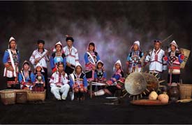
Numbering 18,000 in all, the Jinos live in the Jinoluoke Township of Jinghong County in the Xishuangbanna Dai Autonomous Prefecture, Yunnan Province.
The language of this ethnic minority belongs to the Tibetan-Myanmese group of the Chinese-Tibetan language family. Its structure and vocabulary have much in common with Yi and Myanmese. Without a written language of their own, the Jino people used to keep records by notching on wood or bamboo.
Jinoluoke is a mountainous area stretching for 70 kilometers from east to west and 50 kilometers from north to south. The climate there is rainy and subtropical with an average annual temperature of 18 to 20 degrees. The rainy season lasts from May to September with July and August having the heaviest rainfall. The rest of the year is dry.
Jino land is crisscrossed by numerous rivers and streams, the longest being the Pani and the Small Black rivers. The major crops are upland and wet rice and corn. The famous Pu'er tea grows on Mount Jino. Jinoluoke also has a long history of cotton-growing and is abundant in such tropical fruits as bananas and papayas. Elephants and wild oxen roam the dense primeval forests which are also the habitat of monkeys, hornbills and other birds. Jinoluoke is also rich in mineral resources.
It is said that the Jinos migrated to Jinoluoke from Pu'er and Mojiang or places even farther north. It seems likely that they still lived in a matriarchal society when they first settled around the Jino Mountain. Legend has it that the first settler on the mountain ridge was a widow by the name of Jiezhuo. She gave birth to seven boys and seven girls who later married each other. As the population grew, the big family was divided into two groups to live in as many villages, or rather two clans that could intermarry. One was called Citong, the patriarchal village, and the other was Manfeng, the matriarchal village. With the passage of time, the Jino population multiplied and more Jino villages came into existence.
Kazak (Chinese: 哈萨克族; Pinyin: Hāsàkè Zú)
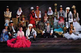
The Kazak ethnic minority, with a population of over a million, mainly lives in the Ili Kazak Autonomous Prefecture, Mori Kazak Autonomous County and Barkol Kazak Autonomous County in the Xinjiang Uygur Autonomous Region. Some are also located in the Haixi Mongolian, Tibetan and Kazak Autonomous Prefecture in Qinghai Province and the Aksay Kazak Autonomous County in Gansu Province.
The Kazak language belongs to the Turkic branch of the Altaic language family. As the Kazaks live in mixed communities with the Hans, Uygurs and Mongolians, the Kazaks have assimilated many words from these languages. They had a written language based on the Arabic alphabet, which is still in use, but a new Latinized written form was evolved after the founding of the Peoplel's Republic of China.
Except for a few settled farmers, most of the Kazaks live by animal husbandry. They migrate to look for pasturage as the seasons change. In spring, summer and autumn, they live in collapsible round yurts and in winter build flat-roofed earthen huts in the pastures. In the yurt, living and storage spaces are separated. The yurt door usually opens to the east, the two flanks are for sleeping berths and the center is for storing goods and saddles; in front are placed cushions for visitors. Riding and hunting gear, cooking utensils, provisions and baby animals are kept on both sides of the door.
The pastoral Kazaks live off their animals. They produce a great variety of dairy products. For instance, Nai Ge Da (milk dough) Nai Pi Zi (milk skin) and cheese. Butter is made from cow's and sheep's milk. They usually eat mutton stewed in water without salt--a kind of meat eaten with the hands. By custom, they slaughter animals in late autumn and cure the meat by smoking it for the winter. In spring and summer, when the animals are putting on weight and producing lots of milk, the Kazak herdsmen put fresh horse milk in shaba (barrels made of horse hide) and mix it regularly until it ferments into the cloudy, sour horse milk wine, a favorite summer beverage for the local people. The richer herdsmen drink tea boiled with cow's or camel's milk, salt and butter. Rice and wheat flour confections also come in a great variety: Nang (baked cake), rice cooked with minced mutton and eaten with the hands, dough fried in sheep's fat, and flour sheets cooked with mutton. Their diet contains few vegetables.
The horse-riding Kazak herdsmen are traditionally clad in loose, long-sleeved furs and garments made of animal skins. The garments vary among different localities and tribes. In winter, the men usually wear sheepskin shawls, and some wear overcoats padded with camel hair, with a belt decorated with metal patterns at the waist and a sword hanging at the right side. The trousers are mostly made of sheepskin. Women wear red dresses and in winter they don cotton-padded coats, buttoned down the front. Girls like to sport embroidered cloth leggings bedecked with silver coins and other silver ornaments, which jangle as they walk. Herdsmen in the Altay area wear square caps of baby-lamb skin or fox skin covered with bright-colored brocade, while those in Ili sport round animal-skin caps. Girls used to decorate their flower-patterned hats with owl feathers, which waved in the breeze. All the women wear white-cloth shawls, embroidered with red-and-yellow designs.
Kirgiz (Chinese: 柯尔克孜族; Pinyin: Kēěrkèzī Zú)
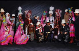
The Kirgiz (also Kyrgyz) ethnic minority, with a population of 143,500, finds 80 per cent of its inhabitants in the Kizilsu Kirgiz Autonomous Prefecture in the southwestern part of the Xinjiang Uygur Autonomous Region. The rest live in the neighboring Wushi (Uqturpan), Aksu, Shache (Yarkant), Yingisar, Taxkorgan and Pishan (Guma), and in Tekes, Zhaosu (Monggolkure), Emin (Dorbiljin), Bole (Bortala), Jinghe (Jing) and Gonliu in northern Xinjiang. Several hundred Kirgiz whose forefathers emigrated to Northeast China more than 200 years ago now live in Wujiazi Village in Fuyu County, Heilongjiang Province.
The Kirgiz language belongs to the Turkic subdivision of the Altaic family of languages. It borrowed many words from the Chinese language after the 1950s, and a new alphabet was then devised, discarding the old Arabic script and adopting a Roman alphabet-based script. The Uygur and Kazak languages are also used by the Kirgiz in some localities.
The forefathers of the Kirgiz lived on the upper reaches of the Yenisey River. In the mid-sixth century CE, the Kirgiz tribe was under the rule of the Turkic Khanate. After the Tang Dynasty (618- 907) defeated the Eastern Turkic Khanate, the Kirgiz came into contact with the dynasty and in the 7th century the Kirgiz land was officially included in China's territory.
From the 7th to the 10th century, the Kirgiz had very frequent communications with the Han Chinese. Their musical instruments -- the drum, sheng (a reed pipe), bili (a bamboo instrument with a reed mouthpiece) and panling (a group of bells attached to a tambourine) -- showed that the Kirgiz had attained quite a high level of culture. According to ancient Yenisey inscriptions on stone tablets, after the Kirgiz developed a class society, there was a sharp polarization and class antagonism. Garments, food and housing showed marked differences in wealth and there were already words for "property," "occupant," "owner" and "slave."
During the Liao and Song dynasties (916- 1279), the Kirgiz were recorded as "Xiajias" or "Xiajiaz". The Liao government established an office in the Xiajias area. In the late 12th century when Genghis Khan rose, Xiajias was recorded in Han books of history as "Qirjis" or "Jilijis," still living in the Yenisey River valley. From the Yuan Dynasty (1206- 1368) to the Ming Dynasty (1368-1644), the Jilijis, though still mainly living by nomadic animal husbandry, had emigrated from the upper Yenisey to the Tianshan Mountains and become one of the most populous Turkic-speaking tribal groups. After the 15th century, though there were still tribal distinctions, the Jilijis tribes in the Tianshan Mountains had become a unified entity.
In the early Qing Dynasty (1644-1911), the Kirgiz, who had remained in the upper Yenisey River reaches, emigrated to the Tianshan Mountains to live together with their kinfolk. Many then moved to the Hindukush and Karakorum Mountains. At this time, some Kirgiz left their homeland and emigrated to Northeast China. In 1758 and 1759, the Sayak and Sarbagex tribes of Eastern Blut and the Edegena tribe of Western Blut, and 13 other tribes- a total of 200,000- entered the Issyk Kul pastoral area and asked to be subjected to the Qing.
The Kirgiz played a major role with their courage, bravery and patriotism in the defense of modern China against foreign aggression.
The Kirgiz and Kazaks assisted the Qing government in its efforts to crush the rebellion by the nobility of Dzungaria and the Senior and Junior Khawaja.
They resisted assaults by the rebellious Yukub Beg in 1864, and when the Qing troops came to southern Xinjiang to fight Yukub Beg's army, they gave them assistance.
Korean (Chinese: 朝鲜族; Pinyin: Cháoxiǎn Zú)

The largest concentration of Koreans is in the Yanbian Korean Autonomous Prefecture in eastern Jilin Province. Under its jurisdiction are the cities of Yanji and Tumen, and the counties of Yanji, Helong, Antu, Huichun, Wangqing and Dunhua, covering a total area of 41,500 sq. km.
The Yanbian Korean Autonomous Prefecture is a beautiful, majestic land of high mountains and deep valleys. The land rises to 2,744 meters above sea level to the highest peak of the Changbai Mountains -- White Head Summit. This is an extinct volcano, from the crater lake of which spring the Yalu and Tumen rivers, flowing south and north respectively, and forming the boundary with the Democratic People's Republic of Korea to the east.
The area is accessible nowadays by both road and rail, except for the mountain-locked Hunchun District. The prefecture has 1,600 km of railways and 3,700 km of highways and branch roads.
Another community of Koreans lives in the Changbai Korean Autonomous County in southeastern Jilin.
The area is one of China's major sources of timber and forest products, including ginseng, marten pelts and deer antlers. It is also a habitat for many wild animals, including tigers.
Copper, lead, zinc and gold have been mined here since the Qing Dynasty (1644-1911), and the area also has deposits of iron, antimony, phosphorus, graphite, quartz, limestone and oil shale.
Yanbian is also blessed with agricultural riches and is a major tobacco producer. It is famous for apples and pears, which have been exported since 1955.
The ancestors of the Korean ethnic group migrated from the Korean peninsula from about the late 17th century, mostly peasants fleeing from their oppressive feudal landlords. Especially following a severe famine in the northern part of Korea in 1869, they settled down in large numbers in what is now the Yanbian area. Another wave of migration took place in the early years of this century when Japan annexed Korea and drove many peasants off the land. The Japanese seizure of the Manchurian provinces further served to drive landless Koreans to settle in Northeast China.
The Koreans have their own spoken and written language, which is thought to belong to the Altaic family. Their alphabet is a simple, ingenious one, and the Koreans are very proud of it.
Lahu (Chinese: 拉祜族; Pinyin: Lāhù Zú)
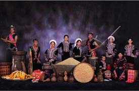
The Lahu ethnic minority has a population of 411,500, mainly distributed in the Lancang Lahu Autonomous County in Simao Prefecture, Southern Lincang Prefecture and Menghai County in western Xishuangbanna in Yunnan Province. Others live in counties along the Lancang River.
The subtropical hilly areas along the Lancang River where the Lahu people live in compact communities are fertile, suitable for planting rice paddy, dry rice, maize, buckwheat as well as tea, tobacco, and sisal hemp. There are China fir and pine, camphor and nanmu trees in the dense forests, which are the habitat of such animals as red deer, muntjacs, wild oxen, bears, peacocks and parrots. Found here are also valuable medicinal herbs like pseudo-ginseng and devil pepper.
Mineral resources in the area include iron, copper, lead, aluminum, coal, silver, mica and tungsten.
The Lahu language belongs to the Chinese-Tibetan language family. Most of the Lahus also speak Chinese and the language of the Dais. In the past the custom of passing messages by wood-carving was prevalent. In some parts the alphabetic script invented by Western priests was in use. After liberation, the script was reformed and became their formal written language.
Legend says that the forbears of the Lahu people, who were hunters, began migrating southward to lush grassland which they discovered while pursuing a red deer.
Some scholars hold that during the Western Han Dynasty more than 2,000 years ago, the "Kunmings," the nomadic tribe pasturing in the Erhai area in western Yunnan, might be the forbears of certain ethnic groups, including the Lahus. Then, the "Kunming" people still lived in a primitive society "without common rulers." They belonged to different clans engaged in hunting. The Lahu people once were known for their skill at hunting tigers. They roved over the lush slopes of the towering Ailao and Wuliang mountains.
In the 8th century, after the rise of the Nanzhao regime in Yunnan, the Lahu people were compelled to move south. By no later than the beginning of the 18th century they already had settled in their present-day places. Influenced by the feudal production methods of neighboring Han and Dai peoples, they turned to agriculture. With economic development, they gradually passed into a feudal system, and their life style and customs were more or less influenced by the Hans and Dais.
Lhoba (Chinese: 珞巴族; Pinyin: Luòbā Zú)
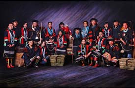
The 2,300 people of the Lhoba ethnic minority have their homes mainly in Mainling, Medog, Lhunze and Nangxian counties in southeastern Tibet. Additionally, a small number live in Luoyu, southern Tibet.
The Lhobas speak a distinctive language belonging to the Tibetan-Myanmese language family, Chinese-Tibetan language system. Few of them know the Tibetan language. Having no written script, Lhoba people used to keep records by notching wood or tying knots.
People of this ethnic group were oppressed, bullied and discriminated against by the Tibetan local government, manorial lords and monasteries under feudal serfdom in Tibet. Being considered inferior and "wild," some were expelled and forced to live in forests and mountains. They were not allowed to leave their areas without permission and were forbidden to do business with other ethnic groups. Intermarriage with Tibetans was banned. They had to make their living by gathering food, hunting and fishing because of low grain yields in the region.
Li (Chinese: 黎族; Pinyin: Lí Zú)
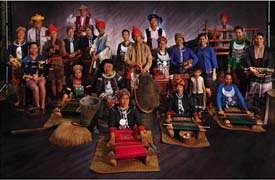
Hainan, China's only island province, is the home of the Li ethnic group with a population of about 1.11 million. Most of them live in and around Tongze, capital of the Hainan Li-Miao Autonomous Prefecture, and Baoting, Ledong, Dongfang and other counties under its jurisdiction; others live among people of the Han and Hui ethnic groups in other parts of the island.
Lying at the foot of the Wuzhi Mountains, the Li area is a tropical paradise with fertile land and abundant rainfall. Coconut palms and rubber trees line the beaches and people in some places reap three crops of rice a year and grow maize and sweet potatoes all the year round. The area is the country's major producer of tropical crops such as coconut, arica, sisal hemp, lemon grass, cocoa, coffee, rubber, oil palm, cashew, pineapple, casava, mango and banana.
The island is abundant in minerals like copper, tin, crystal quarts, phosphorus, iron and tungsten. There are numerous salt pans and many fine harbors along the coast, and good fishing grounds off the shore. Pearls, coral and hawksbill, turtles of commercial value are found in the coastal waters. Black gibbons, civets and peacocks live in the primeval forests which abound with valuable timber trees.
The Lis had no written script. Their spoken language belongs to the Chinese-Tibetan language family. But many of them now speak the Chinese language. A new Romanized script was created for the Li ethnic group in 1957 with government help.
According to historical records, the term "Li" first appeared in the Tang Dynasty (618- 907). The Lis are believed to be descendants of the ancient Yue ethnic group, with especially close relations with the Luoyues -- a branch of the Yues -- who migrated from Guangdong and Guangxi on the mainland to Hainan Island long before the Qin Dynasty (221- 206 BCE). Archaeological finds on the island show that Li ancestors settled there some 3,000 years ago during the late Shang Dynasty or early Zhou Dynasty when they led a primitive matriarchal communal life. Ethnically, the Lis are closely related to the Zhuang, Bouyei, Shui, Dong and Dai ethnic groups, and their languages bear resemblance in pronunciation, grammar and vocabulary. People of the Han ethnic group began to settle on the island also before the Qin Dynasty as farmers, fishermen and merchants. Together, people of the two ethnic groups contributed to the development of Hainan. Later, the Han Dynasty sent troops under Lu Bode and Ma Yuan to set up prefectures and strengthen government control there and enhance relations between the mainland and the island.
In the 6th century, Madame Xian, a political leader of the Yues in southwest Guangdong, Hainan and the Leizhou Peninsula, pledged allegiance to the Sui Dynasty. Her effort in promoting national unity and unification of the country not only enhanced the relationship between Hainan Island and the central part of China but also helped the development of the primitive Li society by introducing feudal elements into it.
The Tang Dynasty (618- 907) further strengthened central control over the Li areas by setting up five prefectures which consisted of 22 counties. In the Song Dynasty (960- 1279), rice cultivation was introduced and irrigation developed, and local farmers were able to grow four crops of ramie annually. Brocade woven by Li women became popular in central China.
In the early Yuan Dynasty, Huang Daopo, the legendary weaver in Chinese history, achieved her excellence by learning weaving techniques from the Lis. Running away as a child bride from her home in Shanghai, she came to Hainan and lived with the Lis there. Returning to Shanghai, she passed on the Li techniques to others and invented a cotton fluffer, a pedal spinning wheel and looms, which were the most advanced in the world at the time.
The feudal mode of production became dominant in Hainan during the Ming and Qing dynasties as elsewhere in China. Most of the land was in the hands of a small number of landlords, and peasants were exploited by usury and land rent. Large tracts of land were seized by the government for official use. Only in the Wuzhi Mountains did people still work the land collectively, but even this remnant of the communal system was used by feudal landlords as a means of exploitation.
Heavy oppression of the Li people kindled flames of uprising. In the Song and Yuan dynasties, the Lis in Hainan staged 18 large-scale uprisings; during the Ming and Qing dynasties 14 major rebellions took place. After the Opium War in 1840, Hainan was invaded by foreign imperialists who brought untold sufferings to the local Li and Han people, who rose repeatedly against the foreign invaders.
The Japanese invaded Hainan Island in February 1939. People of various nationalities in Hainan rose in resistance. In the spring of 1944, an anti- Japanese guerrilla force, the Qiongya Column, was formed. It grew into an army of 7,000 towards the end of the war, liberating three-fifths of the island.
Lisu (Chinese: 傈僳族; Pinyin: Lìsù Zú)
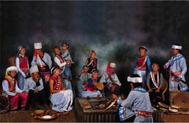
The Lisu ethnic group numbers 574,600 people, and most of them live in concentrated communities in Bijiang, Fugong, Gongshan and Lushui counties of the Nujiang Lisu Autonomous Prefecture in northwestern Yunnan Province. The rest are scattered in Lijiang, Baoshan, Diqing, Dehong, Dali, Chuxiong prefectures or counties in Yunnan Province as well as in Xichang and Yanbian counties in Sichuan Province, living in small communities with the Han, Bai, Yi and Naxi peoples.
The Lisu language belongs to the Chinese-Tibetan language family. In 1957, a new alphabetic script was created for the Lisu people.
The Lisus inhabit a mountainous area slashed by rivers. It is flanked by Gaoligong Mountain on the west and Biluo Mountain on the east, both over 4,000 meters above sea level. The Nujiang River and the Lancang River flow through the area, forming two big valleys. The average annual temperature along the river basins ranges between 17 and 26 degrees Centigrade, and the annual rainfall averages 2,500 millimeters. Main farm crops are maize, rice, wheat, buckwheat, sorghum and beans. Cash crops include ramie, lacquer trees and sugarcane. Many parts of the mountains are covered with dense forests, famous for their China firs. In addition to rare animals, the forests yield many medicinal herbs including the rhizome of Chinese gold thread and the bulb of fritillary. The Lisu area also has abundant mineral and water resources.
According to historical records and folk legend, the forbears of the Lisu people lived along the banks of the Jinsha River and were once ruled by "Wudeng" and "Lianglin," two powerful tribes. After the 12th century, the Lisu people came under the rule of the Lijiang Prefectural Administration of the Yuan Dynasty, and in the succeeding Ming Dynasty, under the rule of the Lijiang district magistrate with the family surname of Mu.
During the 1820s, the Qing government sent officials to Lijiang, Yongsheng and Huaping, areas where the Lisus lived in compact communities, to replace Naxi and Bai hereditary chieftains. This practice speeded up the transformation of the feudal manorial economy to a landlord economy, and tightened up the rule of the Qing court over Lisu and other ethnic groups. In the years preceding and following the turn of the 20th century, large numbers of Han, Bai and Naxi peoples moved to the Nujiang River valleys, taking with them iron farm tools and more advanced production techniques, giving an impetus to local production.
For a long time the Lisus, under oppression and exploitation by landlords, chieftains and headmen, as well as the Kuomintang and foreign imperialists, led a miserable life. In Eduoluo Village of Bijiang County alone, 237 peasants out of the village's 1,000 population were tortured to death in the 10 years prior to liberation by local officials, chieftains, headmen or landlords. The Lisus also suffered exorbitant taxes and levies. The household tax, for example, was 21 kilograms of maize per capita, accounting for 21 per cent of the annual grain harvest. Moreover, there were unscrupulous merchants and usurers. The arrival of imperialist influence at the turn of the 20th century put the Lisus in a far worse plight.
During the period between the 18th and 19th century, the Lisus waged many struggles against oppression. From 1941 to 1943, together with the Hans, Dais and Jingpos, they heroically resisted the Japanese troops invading western Yunnan Province and succeeded in preventing the aggressors from crossing the Nujiang River, contributing to the defense of China's frontier.
Manchu (Chinese: 满族; Pinyin: Mǎn Zú)
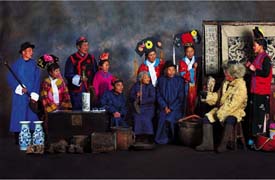
Like the Han people, the majority ethnic group in China, over 70 per cent of the Manchus are engaged in agriculture-related jobs. Their main crops include soybean, sorghum, corn, millet, tobacco and apple. They also raise tussah silkworms. For Manchus living in remote mountainous areas, gathering ginseng, mushroom and edible fungus makes an important sideline. Most of the Manchu people in cities, who are better educated, are engaged in traditional and modern industries.
Manchus have their own script and language, which belongs to the Manchu-Tungusic group of the Altaic language family. Beginning from the 1640s, large numbers of Manchus moved to south of the Shanhaiguan Pass (east end of the Great Wall), and gradually adopted Mandarin Chinese as their spoken language. Later, as more and more Han people moved to north of the pass, many local Manchus picked up Mandarin Chinese too.
An ethnic group originally living in forests and mountains in northeast China, the Manchus excelled in archery and horsemanship. Children were taught the art of swan-hunting with wooden bows and arrows at six or seven, and teenagers learned to ride on horseback in full hunting gear, racing through forests and mountains. Women, as well as men, were skilled equestrians.
The ancestry of the Manchus can be traced back more than 2,000 years to the Sushen tribe, and later to the Yilou, Huji, Mohe and Nuzhen tribes native to the Changbai Mountains and the drainage area of the Heilong River in northeast China.
As testified to by the stone arrowheads and pomegranate-wood bows they sent as tributes to rulers of the Western and Eastern Zhou period (11th century- 221 BCE), the Sushens were one of the earliest tribes living along the reaches of the Heilong and Wusuli rivers north of the Changbai Mountains.
After the Warring States Period (475- 221 BCE), the Sushens changed the name of their tribe to Yilou. They ranged over an extensive area covering the present-day northern Liaoning Province, the whole of Jilin Province, the eastern half of Heilongjiang Province, east of the Wusuli River, and north of the Heilong River. Stone arrowheads and pomegranate-wood bows still distinguished the Yilous in hunting wild boar. They also mastered such skills as raising hogs, growing grain, weaving linen and making small boats. They pledged allegiance to dynastic rulers on the Central Plains after the Three Kingdoms period (220- 280).
During the period between the 4th and 7th centuries, descendants of the Yilous called themselves Hujis and Mohes, consisting of several dozen tribes.
By the end of the 7th century a local power called the State of Zhen with the Mohes of the Sumo tribe as the majority was formed under the leadership of Da Zuorong on the upper reaches of the Songhua River north of the Changbai Mountains. In 713, the Tang court conferred on Da Zuorong the title of "King of Bohai Prefecture" and made him "Military Governor of Huhan Prefecture." Da's domain, known afterwards as the State of Bohai, showed marvelous skills in iron smelting and silk weaving. With its political and military institutions modeled on those of the Tang Dynasty (618- 907), this society adopted the Han script. Under the influence of the political and economic systems of the central part of China and the more developed science and culture there, speedy advances were made in agriculture and handicraft industries.
Then the Liao Dynasty (916- 1125) conquered the State of Bohai and moved the Bohai tribesmen southward. Along with this movement, the Mohes in the Heilong River valley made a southward expansion. Gradually a people known as Nuzhens built a powerful state in the former domain of Bohai.
The early 12th century saw a successful insurrection led by Aguoda with the Wanyan tribe of the Nuzhen people as a key force in their fight against the Liao Dynasty, founding the regime of Kin (1115- 1234). After the termination of the Liao, the Kin armies destroyed the Northern Song (960- 1126) and rose as a power in opposition to the rule of the Southern Song (1127- 1279). Moving to live en masse on the Central Plains, the Nuzhens gradually became assimilated with the Han people.
Early in the 13th century, the Nuzhens were conquered by the Mongols and later came under the rule of the Yuan Dynasty (1271- 1368). With the largest concentration in Yilan, Heilongjiang Province, they settled on the middle and lower reaches of the Heilong River and along the Songhua and Wusuli rivers, extending to the sea in the east. The Yuan Dynasty enlisted the service of local upper-strata residents to create five administrations each governing 10,000 house-holds, known respectively as Taowen, Huligai, Woduolian, Tuowolian and Bokujiang. The Nuzhens at this time were still leading a primitive life. They developed and progressed, until Nurhachi's son proclaimed the name of Manchu towards the end of the Ming Dynasty (1368- 1644).
The Ming Dynasty had 384 military forts and outposts established in the Nuzhen area, and the Nuergan Garrison Command, a local military and administrative organization in Telin area opposite the confluence of the Heilong and Henggun rivers, was placed directly under the Ming court. While strengthening central government control over northeast China, these establishments aided the economic and cultural exchanges between the Nuzhen and Han peoples.
From the mid-16th century onwards, repeated internecine wars broke out among the Nuzhens, but they were later reunified by Nurhachi, who was then Governor of Jianzhou Prefecture.
In 1595, the Ming court conferred on Nurhachi the title of "Dragon-Tiger General" after making him a garrison commander in 1583 and public procurator of Heilongjiang Province in 1589. Frequent trips to Beijing brought him full awareness of developments in the Han areas, which in turn exerted great influence on him. A talented political and military leader, he later proved his outstanding ability by welding together within 30 years all the Nuzhen tribes that were scattered over a vast area reaching as far as the sea in the east, Kaiyuan in the west, the Nenjiang River in the north and the Yalu River in the south.
Once the Nuzhens were united, Nurhachi initiated the "Eight banner" system, under which all people were organized along military lines. Each banner consisted of many basic units called "niulu" which functioned as the primary political, military and production organization of the Manchu people, and each unit was formed of 300 people. Members of these units hunted or farmed together in peace time, and in time of war all would go into battle as militia.
In 1619 Nurhachi proclaimed himself "Sagacious Khan" and established a slave state known to later times as Late Kin.
Maonan (Chinese: 毛南族; Pinyin: Màonán Zú)
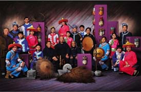
The Maonan ethnic minority has a population of 72,400, living in the northern part of the Guangxi Zhuang Autonomous Region.
The Maonan communities are located in sub-tropical areas characterized by a mild climate and beautiful scenery, with stony hills jutting up here and there, among which small patches of flatland are scattered. There are many small streams which are used to irrigate paddy rice fields. Drought-resistant crops are grown in the Dashi Mountain area where water is scarce. In addition to paddy rice, agricultural crops include maize, wheat, Chinese sorghum, sweet potatoes, soybean, cotton and tobacco. Special local products include camphor, palm fiber and musk. The area abounds in mineral resources such as iron, manganese, stibium and mercury. The Maonans are experts in raising beef cattle, which are marketed in Shanghai, Guangzhou and Hong Kong.
People surnamed Tan take up 80 per cent of the population. Legend has it that their ancestors earlier lived in Hunan Province, then emigrated to Guangxi and multiplied by marrying the local women who spoke the Maonan tongue. There are other Maonans surnamed Lu, Meng, Wei and Yan, whose ancestral homes are said to have been in Shandong and Fujian provinces.
The Maonan language belongs to the Dong-Shui branch of the Zhuang-Dong language group of the Chinese-Tibetan language family. Almost all the Maonans know both the Han and the Zhuang languages because of long contact with those people.
Long subjected to the oppression of the ruling class, the Maonan areas developed very slowly. At the end of the Ming Dynasty (1368- 1644), the Maonans still used wooden hoes and ploughs. Various iron tools were in use by the time of Qing Dynasty (1644- 1911), when land was gradually concentrated and the division of classes became distinct. There began to appear farm laborers who did not own an inch of land, poor peasants who had a small amount of land, self-sufficient middle peasants, and landlords and rich peasants who owned large amounts. The landlords and rich peasants cruelly exploited farm laborers and poor peasants by means of land rent and usury. There were also slave girls either bought by the landlords or forced by unpaid debts to serve landlords all their lives.
Miao (Chinese: 苗族; Pinyin: Miáo Zú)
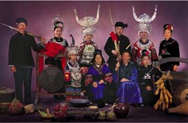
With a population of more than seven million, the Miao people form one of the largest ethnic minorities in southwest China. They are mainly distributed across Guizhou, Yunnan, Hunan and Sichuan provinces and Guangxi Zhuang Autonomous Region, and a small number live on Hainan Island in Guangdong Province and in southwest Hubei Province. Most of them live in tightly-knit communities, with a few living in areas inhabited by several other ethnic groups.
On the Yunnan-Guizhou Plateau and in some remote mountainous areas, Miao villages are comprised of a few families, and are scattered on mountain slopes and plains with easy access to transport links.
Much of the Miao area is hilly or mountainous, and is drained by several big rivers. The weather is mild with a generous rainfall, and the area is rich in natural resources. Major crops include paddy rice, maize, potatoes, Chinese sorghum, beans, rape, peanuts, tobacco, ramie, sugar cane, cotton, oil-tea camellia and tung tree. Hainan Island is abundant in tropical fruits.
As early as the Qin and Han dynasties 2,000 years ago, the ancestors of the Miao people lived in the western part of present-day Hunan and the eastern part of present-day Guizhou. They were referred to as the Miaos in Chinese documents of the Tang and Song period (618- 1279).
In the third century CE, the ancestors of the Miaos went west to present-day northwest Guizhou and south Sichuan along the Wujiang River. In the fifth century, some Miao groups moved to east Sichuan and west Guizhou. In the ninth century, some were taken to Yunnan as captives. In the 16th century, some Miaos settled on Hainan Island. As a result of these large-scale migrations over many centuries the Miaos became widely dispersed.
Such a wide distribution and the influence of different environments has resulted in marked differences in dialect, names and clothes. Some Miao people from different areas have great difficulty in communicating with each other. Their art and festivals also differ between areas.
The Miao language belongs to the Miao-Yao branch of the Chinese-Tibetan language family. It has three main dialects in China -- one based in west Hunan, one in east Guizhou and the other in Sichuan, Yunnan and part of Guizhou. In some places, people who call themselves Miao use the languages of other ethnic groups. In Chengbu and Suining in Hunan, Longsheng and Ziyuan in Guangxi and Jinping in Guizhou, about 100,000 Miao people speak a Chinese dialect. In Sangjiang in Guangxi, over 30,000 Miaos speak the Dong language, and on Hainan Island, more than 100,000 people speak the language of the Yaos. Due to their centuries of contacts with the Hans, many Miaos can also speak Chinese.
Monba (Chinese: 门巴族; Pinyin: Ménbā Zú)
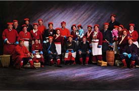
The Moinbas are scattered in the southern part of Tibet Autonomous Region. Most of them live in Medog, Nyingch and Cona counties.
They have forged close links with the Tibetan people through political, economic and cultural exchanges and intermarriage over the years. They share with the Tibetans the common belief in Lamaism and have similar customs and lifestyles.
Their language, which has many dialects, belongs to the Tibetan-Myanmese language family, and many of them can speak Tibetan.
Mongol (Chinese: 蒙古族; Pinyin: Měnggǔ Zú)
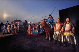
The Mongolians live mostly in the Inner Mongolia Autonomous Region, with the rest residing in Liaoning, Jilin, Heilongjiang, Xinjiang, Qinghai, Gansu, Ningxia, Hebei, Henan, Sichuan, Yunnan and Beijing. /Having their own spoken and written language, which belongs to the Mongolian group of the Altaic language family, the Mongolians use three dialects: Inner Mongolian, Barag-Buryat and Uirad. The Mongolian script was created in the early 13th century on the basis of the script of Huihu or ancient Uygur, which was revised and developed a century later into the form used to this day.
The largest Mongolian area, the Inner Mongolia Autonomous Region with its capital at Hohhot, was founded on May 1, 1947, as the earliest such establishment in China. This vast and rich expanse of land is inhabited by 21,780,000 people, of whom about 2 million are Mongolians and the rest Hans, Huis, Manchus, Daurs, Ewenkis, Oroqens and Koreans.
The Inner Mongolia Autonomous Region is located in the northern part of China. Covering 1.2 million square kilometers and rising 900 to 1,300 meters above sea level, it has vast tracts of excellent natural pastureland with numerous herds of cattle, sheep, horses and camels. The Yellow River Bend and Tumochuan plains, known as a "Granary North of the Great Wall," are crisscrossed with streams and canals. Over southwestern Inner Mongolia flows the Yellow River, which is, among other things, famous for its carp and the well-developed irrigation and transport facilities it has provided for the area. Inner Mongolia also has several hundred richly endowed salt and alkali lakes and many large freshwater lakes, including Hulun Nur, Buir Nur, Ulansu Nur, Dai Hai and Huangqi Hai. More than 60 mineral resources such as coal, iron, chromium, manganese, copper, lead, zinc, gold, silver, tin, mica, graphite, rock crystal and asbestos have been found. The Greater Hinggan Mountain Range in the east part of the region boasts China's largest forests, which are also a fine habitat for a good many rare species of wildlife. This unique natural environment makes the region a famous producer of precious hides, pilose antler, bear gallbladder, musk, Chinese caterpillar fungus (Cordyceps sinensis), as well as 400 varieties of Chinese medicinal herbs, including licorice root, "dangshen" (Codonopsis pilosula), Chinese ephedra (Ephedra sinica), and the root of membranous milk vetch (Astragalus membranaceus). Specialities of the region known far and wide are mushrooms and day lily flowers, which enjoy brisk sales on both the domestic and world markets.
Following the founding of the Inner Mongolia Autonomous Region, autonomous prefectures and counties were established in other provinces where Mongolians live in large communities. These include the two Mongolian autonomous prefectures of Boertala and Bayinguoleng in Xinjiang, the Mongolian and Kazak Autonomous Prefecture in Qinghai, and the seven autonomous counties in Xinjiang, Qinghai, Gansu, Heilongjiang, Jilin and Liaoning. Enjoying the same rights as all other nationalities in China, the Mongolians are joining them in running the country as its true masters.
Mongol was initially the name of a tribe roaming along the Erguna River. Moving to the grasslands of western Mongolia in the 7th century, the Mongols settled in the upper reaches of the Onon, Kerulen and Tula rivers and areas east of the Kentey Mountains in the 12th century. Later, their offshoots grew into many tribal groups, such as Qiyan, Zadalan and Taichiwu. The Mongolian grasslands and the forests around Lake Baikal were also home to many other tribes such as Tartar, Wongjiqa, Mierqi, Woyela, Kelie, Naiman and Wanggu, which varied in size and economic and cultural development.
Early in the 13th century, Temujin of the Mongol tribe unified all these tribes to form a new national community called Mongol. In 1206, he had a clan conference held on the bank of the Onon River, at which he was elected the Great Khan of all Mongols with the title of Genghis Khan. This was followed by the founding of a centralized feudal khanate under aristocratic rule, which promoted the development of Mongolian society. Military conquests ensued on a large scale soon after Temujin's accession to the throne. In 1211 and 1215, he launched massive attacks against the State of Kin (1115- 1234) and captured Zhongdu (present-day Beijing). In 1219 he began his first Western expedition, extending his jurisdiction as far as Central Asia and southern Russia. He died in 1227.
In 1260, Kublai Khan (1215- 1294) became the Great Khan and moved his capital from Helin north of the Gobi Desert to Yanjing, which was later renamed Dadu (Great Capital). In 1272 he founded the Yuan Dynasty (1206- 1368), and in 1279 he subdued the Southern Song (1127- 1279), bringing the whole of China under his centralized rule.
The subsequent Ming Dynasty (1368- 1644) placed the areas where Mongols lived under the administration of more than 20 garrison posts commanded by Mongolian manorial lords. In the early 15th century the Wala (Woyela) and Tartar Mongols living west and north of the Gobi Desert pledged their allegiance to the Ming empire.
In the Qing Dynasty (1644- 1911) more Mongol feudal lords dispatched emissaries to Beijing and presented tributes to the Qing court. Later, some Jungar feudal lords of the Elutes, incited by Tsarist Russia, staged rebellions against the central government. They were put down by the Qing court through repeated punitive expeditions and the Mongolian areas were reunified under the central authorities.
To tighten its control over the various Mongol tribes, the Qing government instituted in Mongolia a system of leagues and banners on the basis of the Manchu Eight-Banner Institution.
The Mongolians have a fine cultural tradition, and they have made indelible contributions to China in culture and science. They created their script in the 13th century and later produced many outstanding historical and literary works, including the Inside History of Mongolia of the Mid-13th Century and the History of the Song Dynasty, History of the Liao Dynasty and History of the Kin Dynasty edited by Tuo Tuo, a Mongolian historian during the Yuan Dynasty. The reign also enjoyed a galaxy of Mongolian calligraphers and authors like Quji Wosier who was credited with many works and translations done in the Han and Tibetan languages. Da Yuan Yi Tong Zhi (China's Unification under the Great Yuan Dynasty) was a famous work of geographical studies compiled under the auspices of the Yuan court. Mongolian architecture in the construction of cities and especially of palaces at that time was also unique.
Further advances in culture were made by Mongolians in the Ming Dynasty. Apart from such great literary and historical works as the Golden History of Mongolia, An Outline of the Golden History of Mongolia and Stories of Heir Apparent Wubashehong, Mongolian scholars produced many grammar books and dictionaries, as well as translations of the Inside History of Mongolia and the Buddhist Scripture Kanjur done into Chinese. These works enriched Mongolian culture and promoted cultural exchanges between the Mongolian, Han and Tibetan people.
The development of Mongolian culture in the subsequent Qing Dynasty was represented by a greater number of dictionaries and reference books like the Principles of Mongolian, A Collection of Mongolian Words and Phrases, Exegesis of Mongolian Words, Mongolian-Tuote Dictionary, Mongolian-Tibetan Dictionary, Manchurian-Mongolian-Han-Tibetan Dictionary, Manchurian-Mongolian-Han-Tibetan-Uygur Dictionary, Manchurian-Mongolian-Han Tibetan-Uygur-Tuote Dictionary and A Concise Dictionary of Manchurian, Mongolian and Han. Noted literary and historical works included The Origin and Growth of Mongolia, Peace and Prosperity Under the Great Yuan Dynasty, Random Notes from the West Studio, Miscellanies from Fengcheng, A Guide to a Means of Life, A One-storied House, and Weeping Scarlet Pavilion. Mongolian scholars also translated such Chinese classics as A Dream of Red Mansions, Outlaws of the Marsh, Romance of the Three Kingdoms and Pilgrimage of the West.
The Stories of Shageder, also produced in this period, has been regarded as the most outstanding work in the treasure-house of Mongolian literature. Other great works of folk literature include the Story of Gessar Khan of the 11th century, the Life Story of Jianggar, an epic of the 15th century.
Mongolians owed their achievements in medical science, astronomy and calendar to the influence of the Hans and Tibetans. Mongolian medicine has been best known for its Lamaist therapy, which is most effective for traumatic surgery and the setting of fractured bones. To further develop their medical science, the Mongolians have translated into Mongolian many Han and Tibetan medical works, which include Mongolian-Tibetan Medicine, A Compendium of Medical Science, The of Secret of Pulse Taking, Basic Theories on Medical Science in Four Volumes, Pharmaceutics and Five Canons of Pharmacology. Outstanding contributions have also been made by the Mongolians in the veterinary science. In the field of mathematics and calendar, credit should be given to the Mongolian astronomist and mathematician Ming Antu. During the decades of his service in the Imperial Observatory, he participated in compiling and editing the Origin and Development of Calendar, Sequel to a Study of Universal Phenomena and A Study of the Armillary Sphere. His work Quick Method for Determining Segment Areas and Evaluation of the Ratio of the Circumference of a Circle to Its Diameter (completed by his son and students) is also a contribution to China's development in mathematics. He also made a name for himself in cartography. It was due to his geographical surveys in Xinjiang that the Complete Atlas of the Empire, the first atlas of China drawn with scientific methods, was finished.
Mosuo (Chinese: 摩梭; Pinyin: Mósuō)
The Mosuo are a small ethnic group living in Yunnan and Sichuan Provinces in China, close to the border with Tibet. Consisting of a population of 50,000, most of them are found near Lugu Lake, high in the Tibetan Himalayas 27°42′35.30″N, 100°47′4.05″E. Although culturally distinct from the Naxi, the Chinese government places them as members of the Naxi minority.
Mulam (Chinese: 仫佬族; Pinyin: Mùlǎo Zú)
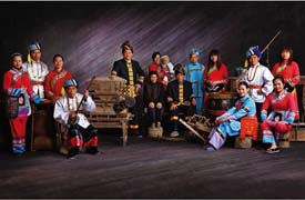
The Mulam ethnic minority has a population of 160,600, of which the majority live in Luocheng County in the Guangxi Zhuang Autonomous Region. Others are scattered in neighboring counties.
The Mulam language is a member of the Zhuang-Dong language group of the Chinese-Tibetan language family, but because of extensive contacts with the majority Han and local Zhuangs many Mulams speak one or both of these languages in addition to their own.
Their homeland is one of rolling hills interspersed with lush green valleys. The Wuyang and Longjiang rivers cross their territory, which has an ideal climate for growing paddy rice, maize, beans, potatoes, melons and cotton. The area is famous for its tea and medicinal herbs, as well as mineral resources such as coal, iron and sulfur.
Historical records trace the Mulam ethnic group back to the period of the Yuan Dynasty (1271- 1368), when their society seems to have been entering the feudal stage. The Mulam villages paid tribute in grain to the imperial court twice a year.
In the Qing Dynasty (1644- 1911) the Mulam areas were divided into "Li," under which were "Dongs"- units of ten households.
The Dong chief was responsible for collecting taxes and law and order. The Dongs were mostly inhabited by families sharing the same surname. Later, when they increased in size, the Dongs were divided into "Fangs."
Naxi (Chinese: 纳西族; Pinyin: Nàxī Zú)
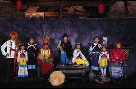
The Naxi ethnic minority has a population of 277,800, most of whom live in concentrated communities in the Lijiang Naxi Autonomous County in Yunnan Province, the rest being scattered in Weixi, Zhongdian, Ninglang, Deqin, Yongsheng, Heqing, Jianchuan and Lanping counties in Yunnan Province, as well as Yanyuan, Yanbian and Muli counties in Sichuan Province. A small number live in Mangkang County of Tibet Autonomous Region.
The Naxi areas, traversed by the Jinsha, Lancang and Yalong rivers, and the Yunling, Xueshan and Yulong mountain ranges, have a complicated terrain. There are cold mountainous areas, uplands, basins, rivers and valleys, averaging 2,700 meters above sea level. The climate varies from cold and temperate to subtropical. Rainfall is plentiful.
Agriculture is the main occupation of the Naxi people. The chief crops are rice, maize, wheat, potatoes, beans, hemp and cotton. The bend of the Jinsha River is heavily forested, and Yulong Mountain is known at home and abroad as a "flora storehouse." The extensive dense forests contain Chinese fir, Korean pine, Yunnan pine and other valuable trees, as well as many varieties of herbs including fritillary bulbs, Chinese caterpillar fungus and musk.
There are rich reserves of such non-ferrous metals as gold, silver, copper, aluminum and manganese. Water resources are abundant.
The Naxi language belongs to the Chinese-Tibetan language family. More than 1,000 years ago, the Naxi people had already created pictographic characters called the "Dongba" script and a syllabic writing known as the "Geba" script. With these scripts they recorded a lot of beautiful folklore, legends, poems and religious classics. However, they were difficult to master, and in 1957 the government helped the Naxi design an alphabetic script. Over the past few hundred years, as the Naxi people have come into closer contact with the people in other parts of China politically, economically and culturally, the oral and written Chinese has become an important means of communication in Naxi society.
According to historical documents, the forefathers of the Naxi people were closely related to a tribe called "Maoniu Yi" in the Han Dynasty (206 BCE- CE 220), "Mosha Yi" in the Jin Dynasty (265- 420) and "Moxie Yi" in the Tang Dynasty (618- 907).
Between the early 10th century and the middle of the 13th century, production in the Lijiang area underwent marked changes, as agriculture replaced livestock breeding as the main occupation of the people. Scores of agricultural, handicraft, mineral and livestock products were turned out, and the county presented a picture of prosperity. During that period, a number of slave-owning groups in Ninglang, Lijiang and Weixi counties gradually grew into a feudal manorial lord caste.
In 1278 the Yuan Dynasty (1206- 1368) established Lijiang Prefecture representing the imperial court in Yunnan Province. This resulted in closer links between the Lijiang area and the center of the empire.
In the early Ming Dynasty (1368- 1644), the leader of the Naxi people, named Mude, was made the hereditary chieftain of Lijiang Prefecture, exercising control over the Naxi people and other ethnic groups in the vicinity. Throughout the Ming Dynasty, the hereditary chieftains from the Mu family kept taxes and tribute flowing to the Ming court in the form of silver and grain. The Ming, in turn, relied on the Mu family as the mainstay for the control of the people of various ethnic groups in northwestern Yunnan Province.
Later, with the development of the productive forces, buying, selling and renting of land began to take place in the Naxi areas, marking the beginning of a landlord economy.
From 1723, during the Qing Dynasty (1644- 1911), hereditary local chieftains in the Lijiang area began to be replaced by court officials and the hereditary chieftain surnamed Mu thus became the local administrator.
Nu (Chinese: 怒族; Pinyin: Nù Zú)
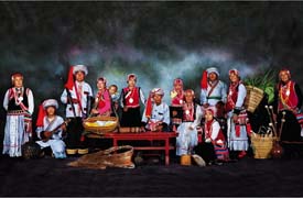
The Nu ethnic minority, numbering some 27,200, live mainly in Yunnan Province's Bijiang, Fugong, Gongshan and Lanping counties, which comprise the Nujiang Lisu Autonomous Prefecture. Others are found in Weixi County in the Diqing Tibetan Autonomous Prefecture.
The Nu people speak a language belonging to the Tibetan-Myanmese group of the Chinese-Tibetan language family. It has no written form, and, like many of their ethnic minority neighbors, the Nus used to keep records by carving notches on sticks; educated Nus nowadays use the Han language (Chinese) for administrative purposes.
The Nu homeland is a country of high mountains and deep ravines crossed by the Lancang, Dulong and Nujiang rivers. The famous Grand Nujiang Canyon is surrounded by mountains, which reach 3,000 meters above sea level. Dense virgin forests of pines and firs cover the mountain slopes and are the habitat of tigers, leopards, bears, deer, giant hawks and pheasants.
The area is rich in mineral deposits and valuable medicinal herbs. In addition, with a warm climate and plentiful rain, it promises great hydroelectric potential.
In the eighth century, the area inhabited by the Nus came under the jurisdiction of the Nanzhao and Dali principalities, which were tributary to the Tang (618- 907) court. During the Yuan and Ming dynasties it came under the rule of a Naxi headman in Lijiang. From the 17th century, rulers comprised various Tibetan and Bai headmen and Tibetan lamaseries. These rulers usurped the Nus' land and carried many of them off as slaves.
From the mid-1850s, the British colonialists who had conquered Myanmur pushed up the Nujiang River valley. They were followed by American, French and German adventurers. This caused friction with the Nu and other minority peoples in the area, such as the Lisu, Tibetan and Drung ethnic minorities. In 1907, these peoples banded together to stage a mass uprising against the encroachments of French missionaries.
Oroqen (Chinese: 鄂伦春族; Pinyin: Èlúnchūn Zú)

People of the Oroqen ethnic minority group dwell in the forests of the Greater and Lesser Hinggan Mountains in Northeast China which abound in deer and other wild beasts the Oroqens hunt with shot-guns and dogs. The Oroqens, who lived in a primitive communal society four and a half decades ago, have leap-frogged several historical stages to a socialist society in the years following the founding of the People's Republic in 1949.
With no written script of their own, the Oroqens have a spoken language belonging to the Tungus branch of the Manchu-Tungusic group of the Altaic language family. Most of them have learned to read and write the language of the Hans, the biggest ethnic group in China.
The Oroqen population, which stood at 4,000 in 1917, dropped to 3,700 in 1943. A census taken in 1953 showed that their number had plummeted to 2,250. The population has started to grow slowly but steadily since, and the census in 1982 showed that their number has reached 4,100. The 1990 national census showed 7,000.
Most of the Oroqens live in the 55,000-square-kilometer Oroqen Autonomous Banner in the Greater Hinggan Mountains. Others have their home in several localities in Inner Mongolia and Heilongjiang Province. Situated in Inner Mongolia's Hulunbuir League, the Oroqen Autonomous Banner is 97 per cent forested land. The seat of the autonomous government is Alihe, a rising town with highways, railways, cinemas, hotels, department stores, restaurants, electric lighting and other modern amenities.
For generations the Oroqens had lived a life of hunting and fishing in the forests. They went on hunting expeditions in groups, and the game bagged was distributed equally not only to those taking part in the hunt, but also to the aged and infirm. The heads, entrails and bones of the animals killed were not distributed but were cooked and eaten by all. Later, deer antlers, which fetched a good price, were not distributed but went to the hunters who killed the animals.
On the eve of the founding of the PRC in 1949, polarization was quite marked in some localities where horses, on which Oroqens rode on hunting trips, belonged to individuals. The rich owned a large number of horses and the poor owned a few. Horses were hired out to those hunters who needed them, and payment took the form of game sent to horse owners. Such a practice gradually developed into rent and exploitation of man by man.
The Oroqens are an honest and friendly people who always treat their guests well. People who lodge in an Oroqen home would often hear the housewife say to the husband early in the morning: "I'm going to hunt some breakfast for our guests and you go to fetch water." When the guests have washed, the woman with gun slung over her shoulders would return with a roe back. The Oroqens are expert hunters. Both the males and females are sharp shooters on horseback. Boys usually start to go out on hunting trips with their parents or brothers at the age of seven or eight. And they would be stalking wild beasts in the deep forest all on their own at 17. A good hunter is respected by all and young maidens like to marry him.
Horses are indispensable to the Oroqens on their hunting expeditions. Hunters ride on horses, which also carry their family belongings and provisions as well as the game they killed over mountains and across marshes and rivers. The Oroqen horse is a very sturdy breed with extra-large hooves that prevent the animal from sinking into marshland.
Oroqen women, who also hunt, show marvelous skill in embroidering patterns of deer, bears and horses on pelts and cloth that go into the making of head gears, gloves, boots and garments. Oroqen women also make basins, bowls, boxes and other objects from birch barks. Engraved with various designs and dyed in color, these objects are artistic works that convey the idea of simplicity and beauty. Taught by their mothers while still very young to rub fur, dry meat and gather fruit in the forest, Oroqen girls start to do household work at 13 or 14. Pelts prepared by Oroqen women are soft, fluffy and light, and they are used in making garments, hats, gloves, socks and blankets as well as tents.
The Oroqens, who led a primitive life, used to have many taboos. One prohibited a woman from giving birth in the home. She had to do that in a little hut built outside the house in which she would be confined for a month before she could return home with her newborn.
Pumi (Chinese: 普米族; Pinyin: Pǔmǐ Zú)
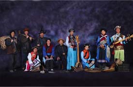
The 29,700 Pumis are concentrated in the Yunnan Province counties of Lanping, Lijiang, Weixi and Yongsheng, as well as in the Yi Autonomous County of Ninglang. Some live in Sichuan Province, in the Tibetan Autonomous County of Muli and Yanyuan County. They are on rugged mountains as high as 2,600 meters above sea level, cut by deep ravines.
According to Pumi legends and historical records, ancient Pumis were a nomadic tribe, roaming the Qinghai-Tibet Plateau. Their descendents later moved south to warmer, more verdant areas along valleys within the Hengduan Mountain Range. By the seventh century, the Pumis were living in Sichuan's Yuexi, Mianning, Hanyuan, Jiulong and Shimian areas, constituting one of the major ethnic minorities in the Xichang Prefecture. After the 13th century, the Pumis gradually settled down in Ninglang, Lijiang, Weixi and Lanping. They farmed and bred livestock. Later, agriculture gradually took a predominant place in their economy.
The Pumis speak a language belonging to the Tibetan-Myanmese language family of the Chinese-Tibetan system. Although Pumis in the Muli and Ninglang areas once wrote with Tibetan characters, this was mainly for religious purposes. Gradually the Tibetan characters fell into oblivion, and most Pumis now use Chinese.
Pumi villages are scattered, usually at least 500 meters from one another, on gentle mountain slopes. Pumis generally build their houses from wood and with two floors, the lower for animals and the upper for people. Almost all family activities indoors take place around the fireplace, which is in the middle of the living room on the upper level.
In addition to maize, their staple food, Pumis also grow rice, wheat and highland barley. Their variety of vegetables and fruits is limited to Chinese cabbage, carrots, eggplant and melons. A favorite food of the Pumis' is "pipa meat" -- salted pork wrapped in pork skin in the shape of a pipa, a plucked string Chinese instrument with a fretted fingerboard. They also like tobacco, tea and liquor. Liquor, in fact, is used both as a sacrificial offering and as a gift for the living.
Qiang (Chinese: 羌族; Pinyin: Qiāng Zú)
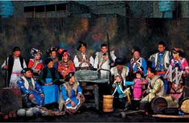
The Qiang ethnic minority has a population of 198,300 who mostly dwell in hilly areas, crisscrossed by rivers and streams, in the Maowen Qiang Autonomous Prefecture in Sichuan Province. A small number live with Tibetan, Han and Hui ethnic groups in such localities as Wenchuan, Dali, Heishui and Songpan.
They occupy a fertile land of mild climate and adequate rain. The mountain slopes are natural pastures. The area abounds in precious Chinese caterpillar fungus, bulb of fritillary, antlers, musk and bear's gallbladders, which are used for medicine. Deep in the forests are such rare animals as giant pandas, golden monkeys and flying foxes. The region is also rich in iron, coal, crystal, mica and plaster stone deposits.
"Qiang" was a name given by ancient Hans to the nomadic people in west China. The Qiangs were not a single distinctive ethnic group then. According to historical records, a clan group made their homes in what is today's Sichuan Province. The Han Dynasty (206 BCE- CE 220) court in the 2nd century had set up an administrative prefecture for the area. During CE 600 to 900 when the Tibetan Regime gradually expanded its rule over the region, some Qiangs were assimilated by the Tibetans and others by the Hans, leaving a small number unassimilated. These developed into the distinctive ethnic group of today.
The Qiangs do not have a written script of their own. They speak a language belonging to the Tibetan-Myanmese language family of the Chinese-Tibetan system. Owing to their close contact with the Han people, many Qiang people speak Chinese, which is also the written form for this ethnic group.
The Qiang and Han peoples have had time-honored close political, economic and cultural ties. Administratively, Han courts from the Qin, Han, Sui and Tang dynasties down to the Ming Dynasty all had political units in the Qiang-occupied areas. In the early Qing Dynasty (1644- 1911), the system of appointing local hereditary headmen by the central authority to rule over the Qiangs gave way to officials dispatched from the court. The central administrative system helped enhance the ties between the Qiang and Han ethnic groups. With their horses, medicinal herbs and other native produce, the Qiangs used to barter farm implements and daily necessities from the Hans. Mutual support and help stimulated the social and economic development of Qiang society.
For a long period before the Communist revolution in 1949, the Qiangs lived in conditions marked by slash and burn farming and whose feudal economy dominated production. Landlords and rich peasants, who accounted for only 8 per cent of the population, were in possession of 43 per cent of the cultivated land. Poor peasants and hired farm hands, accounting for 43 per cent of the population, had only 16 per cent of the land. Many poor peasants lost their land due to heavy rent and became hired laborers, wandering from place to place to make a living.
Russian (Chinese: 俄罗斯族; Pinyin: Éluōsī Zú)
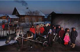
The ethnic Russians in China live in Ili, Tacheng, Altay and Urumqi in the Xinjiang Uygur Autonomous Region and in the Inner Mongolia Autonomous Region.
They first began moving to China from Russia after the 18th century. More entered various parts of Xinjiang after the 19th century, and even after the Bolshevik Revolution in 1917.
They speak Russian, their customs and clothing are almost identical to those of the Russians in Russia, and most of them belong to the Eastern Orthodox Church.
Salar (Chinese: 撒拉族; Pinyin: Sǎlá Zú)
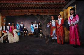
There have been different theories put forward on the origin of the Salars. The prevalent view held at the moment is that the ancestors of the Salars came from the region of Samarkand in Central Asia during the Yuan Dynasty (1271- 1368).
Xunhua County, which the largest group of the Salars live, is a mountainous area situated along the banks of the Yellow River in southeastern Qinghai Province. Although it has a mild climate and fertile land crisscrossed by canals, it is handicapped by insufficient rainfall. Before China's Communist revolution in 1949, farmers did not have the capability of harnessing the Yellow River, and the county was often referred to as "arid Xunhua." The Salars are mainly farmers, going in for such crops as wheat, Tibetan barley, buckwheat and potatoes. As sideline occupations, they engage in stock breeding, lumbering, salt- production and wool-weaving.
During the Yuan Dynasty, a Salar headman bearing the surname of Han was made hereditary chief of this ethnic minority. With the rise of the Ming Dynasty (1368- 1644), he had under him a basic bureaucracy which looked after such things as military affairs, punishments, revenue and provisions. Following the development of the economy and the expansion of the population, the region inhabited by the Salars was divided into two administrative areas, i.e. the "inner eight gongs" of Xunhua and the "outer five gongs" of Hualong, during the early period of the Qing Dynasty (1644- 1911). A "gong" included a number of villages, equivalent to the later administrative unit of "xiang" (township).
New organizational setups were introduced during the following years of the Qian Dynasty to step up the control and exploitation of the Salars. During both the Ming and Qing periods Salar men were constantly subjected to conscription, which was an extremely heavy burden on the Salar people.
As the Salars were devout Muslims, the villages were dominated by the mosques and the Muslim clergy. Along with the development of the feudal economy, land became concentrated in the hands of the ruling minority- the headman, community chiefs and imams.
Prior to the founding of the People's Republic of China in 1949, a feudal economy was dominant. Relying on their political power, the Salar landlords maintained ownership over most of the land and farm animals, as well as water sources and oil mills. Most of the Salar farmers, were either landless or owned only a very insignificant portion of barren land. They were subjected to crippling rents, in addition to all kinds of heavy unpaid labor services including building houses, felling trees and transportation work for the landlords. As a result, at times there were large-scale exoduses of Salars from their villages, leaving the farmlands lying waste and production at a standstill.
The language of the Salars, which belongs to the Tujue (Turkic) branch of the Altaic language family, is almost identical with the languages of the Uygurs and Uzbeks, with whom they share the same religion. It contains quite a number of words taken from the Chinese and Tibetan languages as a result of long years of mutual contacts. Nowadays, most young and middle-aged Salars know how to speak Chinese, which is also accepted as the written language of the Salar ethnic group.
The Salar people have a rich and colorful tradition of folklore. Many of the legends, stories and fairy tales sing the praises of the courage and wisdom of the laboring people, and lament the hard lives of the Salar women in the past, as well as their struggle against feudal oppression. The typical folk tune genre is the "Hua'er (flower)," a kind of folksong sung sonorously and unrestrainedly in the Chinese language. However, in most cases it is presented with a sweet, trilling tone due to the influence of Tibetan folk songs. The singers are all able to fill in impromptu words according to whatever happens to strike a chord in their hearts. Significant reforms have been introduced to this form of art since 1949. Amateur theatrical troupes, and song and dance groups are flourishing among the Salar people.
She (Chinese: 畲族; Pinyin: Shē Zú)
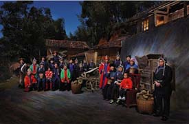
The 634,700 Shes are scattered in Zhejiang, Jiangxi, Jiangxi and Guangdong provinces. They live in villages of several dozen households or live along with Hans. Most reside in hilly country 500 to 1,500 meters high. Rivers have carved out their valleys. The climate is mild and humid, the frost season brief, and the land fertile. Agricultural products abound: rice, sweet potatoes, wheat, rape, beans, tobacco and potatoes are just a few.
Timber and bamboo are important commercial commodities for the Shes; other native produce include tea, oil tea, dried and cured bamboo shoots, peanuts, ramie, mushroom, camphor and medicinal herbs. Mineral resources include coal, iron, gold, copper, alum, graphite, sulfur, talcum, mica and many other non-ferrous metals.
The She language is very close to the Hakka dialect of the Hans, and most Shes speak Chinese instead of their ethnic tongue; a few Guangdong Shes speak a language similar to the Miao.
Sui (Chinese: 水族; Pinyin: Shuǐ Zú)
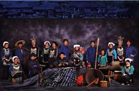
There are in China 286,500 Shuis, the majority of whom dwell on the upper reaches of the Longjiang and Duliu rivers that meander across plains and rolling land interspersed with vast expanses of forests in southern Guizhou Province. They live in compact communities in the Sandu Shui Autonomous County and in Libo, Dushan and other counties. Some Shuis have their homes in the northwestern part of the Guangxi Zhuang Autonomous Region.
The areas in which the Shuis live are a land of plenty, abounding in fish and rice. Wheat, rape, ramie are also grown besides a great variety of citrus and other fruits. The forests are a source of timber and medicinal herbs. The Duliu and other rivers teem with fish.
The Shui language belongs to the Zhuang-Dong branch of the Chinese-Tibetan language family. The Shuis used to have an archaic writing script. Some of their words were pictographs, while others resembled Chinese characters written upside down. Except for scores of these ancient words that are still used for religious purposes, the Shuis use Chinese in their daily lives.
The Shuis boast a treasure house of colorful oral literature and art. Their literature includes poetry, legends, fairy tales and fables. Among the various forms, poetry, which consists of long narrative poems and extemporaneous ballads, are generally considered the most prominent.
Stories and fables in prose style praise the diligence, bravery, wisdom and love of the Shui ethnic group and satirize the stupidity of feudal rulers. With rich content and vivid plots Shui tales are usually highly romantic.
Their songs, which are usually sung without the accompaniment of musical instruments, fall into two categories. The "grand songs" are sung while they work, whereas the "wine songs" are meant for wedding feasts or funerals.
The Shui people are good dancers. "Lusheng Dance" and "Copper Drum Dance" are the most popular dances enjoyed by all on festive occasions. Traditional musical instruments include gongs, drums, lusheng, huqin and suona horns. The Shui people make beautiful handicrafts -- embroideries, batiks, paper cuts and woodcarvings.
Tajik (Chinese: 塔吉克族; Pinyin: Tǎjíkè Zú)
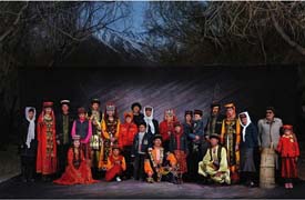
Standing at China's west gate in the eastern part of the Pamirs on the "roof of the world" is the Taxkorgan Tajik Autonomous County in Xinjiang, a town built up since 1950s. It is the place where the ancient Tajik ethnic group has lived generation after generation. Most of the 26,500 Tajiks live in compact communities in Taxkorgan, and the rest are scattered over areas in southern Xinjiang, including Shache, Zepu, Yecheng and Pishan. The Tajiks in Taxkorgan live alongside Uygurs, Kirgizs, Xibes and Hans.
Taxkorgan is perched at the highest part of the Pamirs. The world's second highest peak, Mount Qogir, towers in the south, and in the north stands Mount Muztagata, "the father of ice peaks." In addition, several dozen perennially snow-capped mountains, 5,000 to 6,000 meters above sea level, dot the 25,000-square-kilometer county. For centuries, the Tajiks have been engaged in animal husbandry and farming by making use of the luxuriant pasturage and abundant water resources. Every spring, they sow highland barley, pea, wheat and other cold-resistant crops. They drive their herds to highland grazing grounds in early summer, return to harvest the crops in autumn and then spend winter at home, leading a semi-nomadic life.
Tatar (Chinese: 塔塔尔族; Pinyin: Tǎtǎěr Zú)
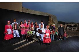
There are about 5,100 Tatars in China, most of whom live in Yining, Tacheng and Urumqi in the Xinjiang Uygur Autonomous Region.
Their history in China dates from the Tang Dynasty (618- 907), when the Tatar tribe was ruled by the nomadic Turkic Khanate in northern China. As this state fell into decline, the Tatars grew in strength, and their name was used to refer to several tribes in the north after the Tang Dynasty. Their homeland was later annexed by Mongols, and when the Mongols pushed west, many Central Asians and Europeans called them Tatars.
In the mid-13th century, Batu, the grandson of Genghis Khan, established the Golden Horde Khanate in Central Asia. It began to decline in the 15th century, and the Kashan Khanate began to rise on the middle reaches of the Volga River and in areas along the Kama River. The rulers of the Kashan Khanate, to boast their strength, began calling themselves Tatars, the sons of the Mongols.
Tatar gradually became the recognized name for the inhabitants of Kashan Khanate. Today's Tatar ethnic group was formed through a mixture of the Baojiaer people, Kipchacks and Mongolians over a long period.
After the 19th century, the serfdom crisis in Tsarist Russia worsened, and serf owners intensified their plundering of land. Most of the Tatars' land along the Volga and Kama was grabbed, and the inhabitants forced to flee. Some went south to Central Asia and then on to southern Xinjiang.
In the late 19th century, Tsarist Russia expanded into Xinjiang, and won trade privileges there. For a time, Russian merchants traveled to Xinjiang, and were followed by Tatar merchants from Kashan. Many stayed in Xinjiang to trade. During this period, many Tatar intellectuals and clerics moved to Xinjiang. Up to the early 20th century, a continuous stream of Tatars came to Xinjiang from Russia.
The Tatar language belongs to the Turkic language family of the Altaic language system. Because the Tatars mix freely in Xinjiang with the Uygurs and the Kazaks, the three languages have had strong effects on one another, and have produced various local dialects. The Tatars' written language is based on Arabic letters.
Tibetan (Chinese: 藏族; Pinyin: Zàng Zú)
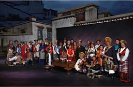
The Tibetans with a population of 4,593,100 mostly live in the Tibet Autonomous Region. There are also Tibetan communities in Qinghai, Gansu, Sichuan and Yunnan provinces.
The Tibetan language belongs to the Tibetan sub-branch of the Tibetan-Myanmese language branch of the Chinese-Tibetan language family. According to geographical divisions, it has three major local dialects: Weizang, Kang and Amdo. The Tibetan script, an alphabetic system of writing, was created in the early 7th century. With four vowels and 30 consonants, it is used in all areas inhabited by Tibetans.
The areas where Tibetans live in compact community are mostly highlands and mountainous country studded with snow-capped peaks, one rising higher than the other. The Qinghai-Tibet Plateau rising about 4,000 meters above sea level is run through from west to east by the Qilian, Kunlun, Tanggula, Gangdise and Himalaya mountain ranges. The Hengduan Mountains, descending from north to south, runs across the western part of Sichuan and Yunnan provinces.
Mt. Qomolangma on the Sino-Nepalese border is 8,848 meters above sea level, the highest in the world. The Tibetan areas are crisscrossed by rivers and dotted with lakes.
Animal husbandry is the main occupation in Tibet where there are vast expanses of grasslands and rich sources of water. The Tibetan sheep, goat, yak and pien cattle are native to the Qinghai-Tibet Plateau. The yak is a big and long-haired animal, capable of with-standing harsh weather and carrying heavy loads. Known as the "Boat on the Plateau," the yak is a major means of transport as well as a source of meat. The pien cattle, a crossbreed of bull and yak, is the best draught animal and milk producer. In farming, the fast ripening and cold- and drought-resistant qingke, a kind of highland barley, is the main crop. Other crops include wheat, pea, buckwheat and broad bean. In the warmer places in the river valleys, there are rape, potato, turnip, apple and walnut. People also grow rice and cotton in river valleys in southern Tibet where the weather is very warm.
The dense forests in the Tibetan areas provide shelter for many precious animals such as sunbird, vulture, giant panda, golden-haired monkey, black leaf monkey, bear and ermine. The forests also produce precious medicines such as bear's gallbladder, musk, pilose antler, caterpillar fungus, snow lotus and glossy ganoderma.
These areas are also richly endowed with hydro-power and mineral resources. There are enormous amounts of hydropower and terrestrial heat for generating electricity, and huge reserves of natural gas, copper, iron, coal, mica and sulfur. The landlocked lakes abound in borax, salt, mirabilite and natural soda. Oilfields have been found in recent years in the Qaidam basin in Qinghai and the northern Tibet Plateau.
The Tibetans first settled along the middle reaches of the Yarlung Zangbo River in Tibet. Evidence of the new and old stone age culture was found in archaeological excavations at Nyalam, Nagqu, Nyingchi and Qamdo. According to ancient historical documents, members of the earliest clans formed tribes known as "Bos" in the Shannan area. In the 6th century, the chief of the Yarlung tribe in the area became leader of the local tribal alliance and declared himself the "Zambo" (king). This marked the beginning of Tibetan slavery society and its direct contacts with the Han people and other ethnic groups and tribes in northwest China.
At the beginning of the 7th century, King Songzan Gambo began to rule the whole of Tibet and made "Losha" (today's Lhasa) the capital. He designated official posts, defined military and administrative areas, created the Tibetan script, formulated laws and unified weights and measures, thus establishing the slavery kingdom known as "Bo," which was called "Tubo" in Chinese historical documents.
After the Tubo regime was established, the Tibetans increased their political, economic and cultural exchanges with the Han and other ethnic groups in China. The Kingdom of Tibet began to have frequent contacts with the Tang Dynasty (618- 907) and the Tibetan and Han peoples got on well with each other. In 641, King Songzan Gambo married Princess Wen Cheng of the Tang Dynasty. In 710, King Chide Zuzain married another Tang princess, Jin Cheng. The two princesses brought with them the culture and advanced production techniques of Central China to Tibet. From that time on, emissaries traveled frequently between the Tang Dynasty and Tibet. The Tibetans sent students to Changan, capital of the Tang Dynasty, and invited Tang scholars and craftsmen to Tibet. These exchanges helped promote relations between the Tibetans and other ethnic groupss in China and stimulated social development in Tibet.
From the 10th to 12th century, Tibet fell apart into several independent regimes and began to move towards serfdom. It was at this time that Buddhism was adapted to local circumstances by assimilating certain aspects of the indigenous religion, won increasing numbers of followers and gradually turned into Lamaism. Consisting of many different sects and spread across the land, Lamaism penetrated into all spheres of Tibetan life. The upper strata of the clergy often collaborated with the rich and powerful, giving rise to a feudal hierarchy combining religious and political power and controlled by the rising local forces.
The Yuan Dynasty (1279- 1368) founded by the Mongols in the 13th century brought the divided Tibet under the unified rule of the central government. It set up an institution called Xuanzhengyuan (or political council) and put it in charge of the nation's Buddhist affairs and Tibet's military, governmental and religious affairs.
Phagsba, a Tibetan lama, was given the title of imperial tutor and appointed head of the council. The Yuan court also set up three government offices to govern the Tibetan areas in northwest and southwest China and Tibet itself. The central government set up 13 Wanhu offices (each governing 10,000 households) in Inner and Outer Tibet east of Ngari. It also sent officials to administer civil and military affairs, conduct census, set up courier stations and collect taxes and levies. Certificates for the ownership of manors were issued to the serf owners and documents given to local officials to define their authority. This marked the beginning of the central authorities' overall control of Tibet by appointing officials and instituting the administrative system there.
The ensuing Ming Dynasty (1368- 1644) carried over the Tusi (headmen) system in the Tibetan areas in northwest and southwest China. In Tibet proper, three sect leaders and five secular princes were named. These measures ensured peace and stability in the Tibetan areas during the Yuan and Ming dynasties, and the feudal economy there developed and culture and art flourished. Tibet's contacts with other parts of the country became more frequent and extensive.
The Qing Dynasty (1644- 1911), the last monarchy in China, set up a government department called Lifanyuan to administer affairs in Tibet and Mongolia. In Tibet, the Qing emperor conferred the titles of the "Dalai Lama" (1653) and "Bainqen Erdini" (1713) on two living Buddhas of the Gelugba sect of Lamaism. The Qing court began to appoint a high resident commissioner to help with local administration in 1728, and set up the Kasha as the local government in 1751. In 1793, the Qing army drove the Gurkhas invaders out of Tibet and formulated regulations concerning its administration.
The regulations specified the civil and military official appointment systems and institutions governing justice, border defense, finance, census, corvee service and foreign affairs, establishing the high commissioners' terms of reference in supervising Tibetan affairs.
In other areas inhabited by Tibetans in northwest and southwest China, the Qing court continued the Tusi (headmen) system established by the Yuan and Ming dynasties, and put them under the administration of the Xining Commissioner's office (established in 1725) and the Sichuan governor (later the Sichuan-Yunnan border affairs minister).
After the Republic of China was founded in 1911, the central government set up a special department to administer Mongolian and Tibetan affairs. In 1929, the Kuomintang government set up a commission for Mongolian and Tibetan affairs in Nanjing and established Qinghai Province. In 1939, Xikang Province was set up. The Tibetan areas in northwest and southwest China, except Tibet, were placed under the administration of Qinghai, Gansu, Sichuan, Xikang and Yunnan provinces respectively.
After the Chinese Communist Party was founded in 1921, its central committee clearly stated in its Agrarian Revolution Program that the feudal privileges of Tibetan princes and Lamas would be abolished. During its Long March northward to fight the Japanese invaders, the Chinese Worker and Peasant Red Army passed through Tibetan areas in Sichuan, Xikang, Yunnan, Gansu and Qinghai, where they mobilized the Tibetans to carry out land reform and establish political power of the laboring people. Tibet proper was forced into the People's Republic after a long, bloody fight forced the Dalai Lama to flee to India in 1951. Since then, the Tibetan culture has given way to Han culture as a result of forced relocations of millions of 'midland' Chinese farming families. The native languages of Tibet are no longer taught in schools in favor of the official Mandarin Chinese and Buddhist lamas must endure approval from the Central government. The Dalai Lama is still the spiritual leader of the Tibetan people, though he lives in Dharamsala, India and has not visited Tibet since 1951. The official position of the Dalai Lama is to seek more autonomy from China's central government for Tibet, not necessarily independence.
Tu (Chinese: 土族; Pinyin: Tǔ Zú)
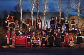
The Tu ethnic minority, known for their simplicity and industriousness, lives in the northwestern part of China -- to the east of Qinghai Lake and south of Qilian Mountain Range and along the banks of the Huangshui and Datong rivers. It is concentrated mainly in the Huzhu Tu Autonomous County in Qinghai Province, and also in the counties of Minhe and Datong. Others are scattered in Ledu, Menyuan and the Tianzhu Tibetan Autonomous County in Gansu Province.
The language of the Tu people belongs to the Mongolian branch of the Altaic language family. Its basic vocabulary is either the same as or similar to that of the Mongolian language, but it is much closer to the languages of the Dongxiang and Bonan ethnic minorities. Quite a number of religious terms are borrowed from the Tibetan language, while a good portion of everyday words, as well as new terms and phrases, come from the Han language, which has long been the medium of communication among the Tus of Datong County. The Tu people do not have a written language of their own; they use that of the Hans instead.
Tujia (Chinese: 土家族; Pinyin: Tǔjiā Zú)
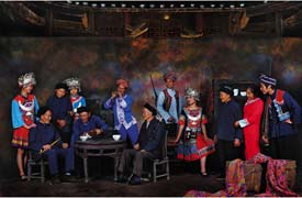
In the Wuling Range of western Hunan and Hubei provinces, at elevations from 400 to 1,500 meters, dwell 5.72 million people called the Tujias. They live mainly in the Xiangxi Tujia-Miao Autonomous Prefecture, Exi Tujia-Miao Autonomous Prefecture and some counties in southeastern Hunan and western Hubei. In these areas, the climate is mild but rainy, and the land is well-forested.
The Youshui, Fengshui and Qingjiang rivers intersect there, and on the terraced mountainsides and in the green valleys grow rice, maize, wheat and potatoes. Cash crops include beets, ramie, cotton, tung oil, oil tea and tea, with oil tea and tung oil playing key commercial roles. Timber includes pine, China fir, cypress and the nanmu tree. The area is rich in rare medicinal herbs, minerals, aquatic products and giant salamanders.
About 20,000-30,000 people living in remote areas such as Longshan speak Tujia, a language which is similar to that spoken by the Yis and belongs to the Chinese-Tibetan language system. But the large majority has come to speak the Han and Miao languages, now that the Tujias have been largely assimilated. Their clothing and customs are very much like those of the Hans. Old Tujia ways survive only in remote area.
Uygur (Chinese: 维吾尔族; Pinyin: Wéiwúěr Zú)

Almost all the Uygurs are found in Xinjiang Uygur Autonomous Region which covers more than 1,709,400 square kilometers or approximately one sixth of China's total landmass, and is by far the biggest of the country's regions and provinces. It occupies much of the sparsely-populated Northwest.
Besides the Uygur ethnic group, Han, Kazak, Hui, Mongolian, Kirgiz, Tajik, Xibe, Uzbek, Manchu, Daur, Tatar and Russian people also live in Xinjiang. The Uygurs is the largest ethnic group in Xinjiang. They believe in Islam.
The region is bounded by the Altay Mountains in the north, the Pamirs in the west, the Karakoram Mountains, Altun Mountains and Kunlun Mountains in the south. The Tianshan Mountains divide Xinjiang into northern and southern parts with very different climate and landscape. Southern Xinjiang includes the Tarim Basin and the Taklimakan Desert, China's largest, while northern Xinjiang contains the Junggar Basin, where the Karamay Oilfields and the fertile Ili River valley are situated. The Turpan Basin, the hottest and lowest point in China, lies at the eastern end of the Tianshan Mountains. The Tarim, Yarkant, Yurunkax and Qarran rivers irrigate land around the Tarim Basin, while the Ili, Irtish, Ulungur and Manas rivers flow through arable and pastoral areas in northern Xinjiang. Many of the rivers spill into lakes. The Lop Nur, Bosten (Bagrax), Uliungur and Ebinur lakes teem with fish.
Xinjiang's climate is dry and warm in the south, and cold in the north with plenty rainfall and snow. The Uygurs farm areas around the Tarim Basin and the Gobi Desert. Wheat, maize and paddy rice are the region's main grain crops, and cotton is a major cash crop. Since the 1950s, cotton has been grown in the Manas River valley north of 40 degrees latitude. The Tianshan Mountains are rich in coal and iron, the Altay in gold, and the Kunlun in jade. The region also has big deposits of non-ferrous and rare metals and oil, and rich reserves of forests and land open to reclamation.
Xinjiang has been part of China since ancient times. The Uygurs, together with other ethnic groups, have opened up the region and have had very close economic and cultural ties with people in other parts of the country, particularly central China.
Xinjiang was called simply "Western Region" in ancient times. The Jiaohe ruins, Gaochang ruins, Yangqi Mansion of "A Thousand Houses," Baicheng (Bay) Kizil Thousand Buddha Grottoes, Bozklik Grottoes in Turpan, Kumtula Grottoes in Kuqa and Astana Tombs in Turpan all contain a great wealth of relics from the Western and Eastern Han dynasties (206 BCE- CE 220). They bear witness to the efforts of the Uygurs and other ethnic groups in Xinjiang in developing China and its culture.
Zhang Qian, who lived in the second century BCE, went to the Western Region as an official envoy in 138 and 119 BCE, further strengthening ties between China and central Asia via the "Silk Road." In 60 BCE, Emperor Xuan Di of the Western Han Dynasty established the Office of Governor of the Western Region to supervise the "36 states" north and south of the Tianshan Mountains with the westernmost border running through areas east and south of Lake Balkhash and the Pamirs.
During the Wei, Jin, Northern and Southern dynasties (220- 581 CE) the Western Reigon was a political dependent of the government in central China. The Wei, Western Jin, Earlier Liang (317- 376), Earlier Qin (352- 394) and Later Liang (386- 403) dynasties all stationed troops and set up administrative bodies there. In 327, Zhang Jun of the Earlier Liang Dynasty set up in Turpan the Gao Chang Prefecture, the first of its kind in the region.
In the mid-seventh century, the Tang Dynasty established the Anxi Governor's Office in Xizhou (present-day Turpan, it later moved to Guizi, present-day Kuqa) to rule areas south and north of the Tianshan Mountains. The superintendent's offices in the Pamirs were all under the jurisdiction of the Anxi Governor's Office. In the meantime, four Anxi towns of important military significance- Guizi, Yutian (present-day Hotan), Shule (present-day Kashgar) and Suiye (on the southern bank of the Chu River)- were established.
In the early eighth century, the Tang Dynasty added Beiting Governor's Office in Tingzhou (present-day Jimsar). The Beiting and Anxi offices, with an administrative and military system under them, implemented effectively the Tang government's orders.
In the early 13th century, Genghis Khan (1162- 1227) appointed a senior official in the region. The Yuan Dynasty (1271- 1368) established Bieshibali (present-day areas north of Jimsar) and Alimali (present-day Korgas) provinces. The Hami Military Command was set up during the Ming Dynasty (1368- 1644). During the Qing Dynasty (1644-1911) the northern part of the Western Region, namely, north of Irtish River and Zaysan Lake, was under Zuo Fu General's Office in Wuliyasu. The General's Office in Ili exercised power over areas north and south of the Tianshan Mountains, east and south of Lake Balkhash and the Pamirs. Xinjiang was made a province in 1884, the 10th year of the reign of Emperor Guang Xu.
Uygur means "unity" or "alliance." The origin of the ethnic group can be traced back to the Dingling nomads in northern and northwestern China and in areas south of Lake Baikal and between the Irtish River and Lake Balkhash in the third century B.C. Some people maintain that the forefathers of the Uygurs were related to the Hans. The Dingling were later called the Tiele, Tieli, Chile or Gaoche (high wheel). The Yuanhe tribe reigned supreme among the Gaoche tribes during the fifth century CE, and the Weihe among the Tiele during the seventh century. Several tribes rallied behind the Weihe to resist Turkic oppression.
These ancient Uighur people were finally conquered by Turkic Kirghiz in the mid-ninth century. The majority of the Uighurs, who were scattered over many areas, moved to the Western Region under the Anxi Governor's Office, and areas west of Yutian. Some went to the Tufan principality in western Gansu Province. The Uighurs who settled in the Western Region lived commingled with Turkic nomads in areas north of the Tianshan Mountains and western pasturelands as well as with Hans, who had emigrated there after the Western and Eastern Han dynasties. They intermarried with people in southern Xinjiang and Tibetan, Qidan (Khitan) and Mongol tribes, and evolved into the group now known as the Uygurs.
The Uygurs made rapid socio-economic and cultural progress between the ninth and the 12th centuries. Nomadism gave way to settled farming. Commercial and trade ties with central China began to thrive better than ever before. Through markets, they exchanged horses, jade, frankincense and medicines for iron implements, tea and silk. With the feudal system further established, a land and animal owners' class came into being, comprising Uygur khans and Bokes (officials) at all levels. After Islam was introduced to Kashgar in the late 10th century, it gradually extended its influence to Shache (Yarkant) and Yutian, and later in the 12th century to Kuya and Yanqi, where it replaced Shamanism, Manichae, Jingism (Nestorianism, introduced to China during the Tang Dynasty), Ao'ism (Mazdaism) and Buddhism, which had been popular for hundreds of years. Western Region culture developed quickly, with Uygur, Han, Sanskrit, Cuili and Poluomi languages, calendars and painting styles being used. Two major centers of Uygur culture and literature- Turpan in the north and Kashgar in the south -- came into being. The large number of government documents, religious books and folk stories of this period are important works for students of the Uygur history, language and culture.
In the early 12th century, part of the Qidan tribe moved westward from north-east China under the command of Yeludashi. They toppled the Hala Khanate established by the Uygurs, Geluolu and other Turkic tribes in the 10th century, and founded the Hala Khanate of Qidan (Black Qidan), or Western Liao as it is now referred to by historians. The state of Gao Chang became its vassal state. After the rise of the Mongols, most of Xinjiang became the territory of the Jagatai Khanate. In the meantime, when many Hans were sent to areas either south or north of the Tianshan Mountains to open up waste land, many Uygurs moved to central China. The forefathers of the Uygurs and Huis in Changde and Taoyuan counties in Hunan Province today moved in that exodus. The Uygurs exercised important influence over politics, economy, culture and military affairs. Many were appointed officials by the Yuan court and, under the impacts of the Han culture, some became outstanding politicians, military strategists, writers, historians and translators.
The Uygur areas from Hami in the east to Hotan in the south were unified into a greater feudal separatist Kashgar Khanate after more than two centuries of separatism and feuding from the late 14th century. As the capital was moved to Yarkant, it was also known as the Yarkant Khanate. Its rulers were still the offspring of Jagatai. During the early Qing period, the Khanate was a tributary of the imperial court and had commercial ties with central China. After periods of unsteady relations with the Ming Dynasty, the links between the Uygurs and ethnic groups in central China became stronger. Gerdan, chief of Dzungaria in northern Xinjiang, toppled the Yarkant Khanate in 1678 and ruled the Uygur area. The Qing army repelled in 1757 (the 22nd year of the reign of Emperor Qian Long) the separatist rebellion by the Dzungarian nobles instigated by the Russian Tsar, and in 1759 smashed the "Batu Khanate" founded by Poluonidu and Huojishan, the Senior and Junior Khawaja, in a separatist attempt.
The Qing government introduced a system of local military command offices in Xinjiang. It appointed the General in Ili as the highest Western Regional Governor of administrative and military affairs over northern and southern Xinjiang and the parts of Central Asia under Qing influence and the Kazak and Blut (Kirgiz) tribes. For local government, a system of prefectures and counties was introduced.
The imperial court began to appoint and remove local officials rather than allowing them to pass on their titles to their children. This weakened to some degree the local feudal system. The court also encouraged the opening up of waste land by garrison troops and local peasants, the promotion of commerce and the reduction of taxation, which were important steps in the social development of Uygur areas.
Xinjiang was completely under Qing Dynasty rule after the mid-18th century. Although political reforms had limited the political and economic privileges of the feudal Bokes (lords), and taxation was slightly lower, the common ethnic people's living standards did not change significantly for the better. The Qing officials, through local Bokes, exacted taxes even on "garden trees." The Bokes expanded ownership on land and serfs, controlled water resources and manipulated food grain prices for profit.
Harsh feudal rule and exploitation gave rise to the six-month-long Wushi (Uqturpan) uprising in 1765, the first armed rebellion by the Uygur people against feudalism. With the aim of preserving their rule and getting rid of Qing control, Uygur feudal owners made use of struggles between religious factions to whip up nationalism and cover up the worsening class contradictions. Zhangger, grandson of the Senior Khawaja, a representative of those owners, under the banner of religion and armed with British-supplied weapons, harassed southern Xinjiang many times from 1820 to 1828, but failed to win military victory.
Uzbek (Chinese: 乌孜别克族; Pinyin: Wūzībiékè Zú)
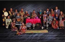
The Uzbek ethnic minority, with a population of 14,800, is scattered over wide areas of the Xinjiang Uygur Autonomous Region. Most of them being city dwellers, the Uzbeks live in compact communities in Yining, Tacheng, Kashi, Urumqi, Shache, and Yecheng.
The name Uzbek first originated from the Uzbek Khan, one of the local rulers under the Mongol Empire in the 14th century. Himself a Moslem, the Uzbek Khan spread Islam in his Khanate. In the 15th century, a number of Uzbeks moved to the Chuhe River valley, where they were called Kazaks. Those who remained in the area of the Khanate continued to be known as Uzbeks, who later formed the Uzbek alliance.
The ancestors of the Uzbek group moved to China's Xinjiang from Central Asia in ancient times. In the Yuan Dynasty (1271- 1368), Uzbek merchants often traveled along "the Silk Road" through Xinjiang to do business in inland areas. In the 16th and 17th centuries, Uzbek trading caravans from Buhara and Samar Khan used Yarkant in Xinjiang as an entry port for business deals in silk, tea, chinaware, fur, rhubarb and other such products. Some Uzbek merchants moved goods to inland areas via Aksu, Turfan and Suzhou (present-day Jiuquan of Ganzu Province). During this period, Uzbeks from Central Asia began to settle in certain cities in Xinjiang, and the number grew with each passing year. Later on Uzbeks also settled in Kashi, Aksu, Yarkant and other cities in southern Xinjiang and a number of places in northern Xinjiang.
Va (Chinese: 佤族; Pinyin: Wǎ Zú)
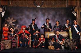
The Va ethnic minority, with a population of 352,000, lives in Ximeng, Cangyuan, Menglian, Gengma, Lancang, Shuangjiang, Zhenkang and Yongde counties in southwestern Yunnan Province. Some are found scattered in the Xishuangbanna Dai Autonomous Prefecture and the Dehong Dai-Jingpo Autonomous Prefecture. Ximeng and Cangyuan counties are the main places where the Va people live in compact communities. In the areas where the Va people live, there are also Hans, Yis, Dais, Hanis, Lahus, Jingpos, Blangs, De'angs and Lisus.
Ximeng, Cangyuan, Menglian and Langcang are situated between the Lancang and Nu rivers, blocked by undulating mountain ridges some 2,000 meters above sea level. Traditionally this area was called the Ava hilly region.
With a subtropical climate, the fertile Ava region has plentiful rainfall and only 40 frost-free days a year. It is suitable for the growth of dry rice, paddy, maize, millet, buckwheat, potatoes, cotton, hemp, tobacco and sugarcane, as well as such subtropical fruits as bananas, pineapples, mangoes, papayas and oranges.
The Va language belongs to the Austroasiatic family. Before the founding of the People¡¯s Republic of China in 1949, except for some parts of the area where an alphabetic script was used, the Va people had no written language, and they kept records and accounting or passed messages with material objects or by engraving bamboo strips. Each strip ranged from half an inch to an inch in width. Objects used implied specific meaning or feelings. For instance, sugarcane, banana or salt meant friendship, hot pepper anger, feather urgency, and gunpowder and bullets the intention of clan warfare. An alphabetic script was created for the Va people in 1957.
Xibe (Chinese: 锡伯族; Pinyin: Xíbó Zú)

The Xibe ethnic minority, with a population of 127,900, is widely distributed over northern China from the Ili area in the Xinjiang Uygur Autonomous Region in the west to the northeast provinces of Jilin and Liaoning.
The Xibe people in northeast and northwest China have each formed their own characteristics in the course of development. The language and eating, dressing and living habits of the Xibes in the northeast are close to those of the local Han and Manchu people. Living in more compact communities, those in Xinjiang have preserved more of the characteristics of their language script and life styles. The Xibe language belongs to the Manchu-Tungusic branch of the Altaic Language Family. Legend has it that the Xibe ethnic group once had its own script but has lost it after the Qing Dynasty (1644- 1911) was founded. A growing number of Xibe people came to learn the Manchu and Han languages, the latter being more widely used. In Xinjiang, however, some Xibe people know both the Uygur and Kazak languages. In 1947, certain Xibe intellectuals reformed the Manchu language they were using by dropping some phonetic symbols and adding new letters of the Xibe language. This Xibe script has been used as an official language by the organs of power in the autonomous areas.
The Xibe ethnic minority in Xinjiang believed in Polytheism before China's Communist revolution in 1949. In addition to the gods of insect, dragon, land and smallpox, the Xibes also worshipped divine protectors of homes and animals. Besides, some Xibe people believe in Shamanism and Buddhism. The Xibe people are pious worshippers of ancestors, to whom they offer fish every March and melons every July.
Yao (Chinese: 瑶族; Pinyin: Yáo Zú)

The Yaos, with a population of 2.13 million, live in mountain communities scattered over 130 counties in five south China provinces and one autonomous region. About 70 per cent of them live in the Guangxi Zhuang Autonomous Region, the rest in Hunan, Yunnan, Guangdong, Guizhou and Jiangxi provinces.
Historically, the Yaos have had at least 30 names based on their ways of production, lifestyles, dresses and adornments. The name "Yao" was officially adopted after the founding of the People's Republic in 1949.
Half of the Yaos speak the Yao language belonging to the Chinese-Tibetan language family, others use Miao or Dong languages. As a result of close contacts with the Hans and Zhuangs, many Yaos also have learned to speak Chinese or Zhuang language.
Before 1949, the Yaos did not have a written language. Ancient Yaos kept records of important affairs by carving notches on wood or bamboo slips. Later they used Chinese characters. Hand-written copies of words of songs are on display in the Jinxiu Yao Autonomous County in Guangxi. They are believed to be relics of the Ming Dynasty (1368- 1644). Ancient stone tablets engraved with Chinese characters can be found in a lot of Yao communities.
Most Yaos live in beautiful, humid mountain valleys densely covered with pines, firs, Chinese firs, Chinese cinnamons, tung oil trees, bamboos and tea bushes. The thickly forested Jianghua Yao Autonomous County in Hunan is renowned as the "home of Chinese firs." The places inhabited by the Yaos also abound in indigo, edible funguses, bamboo shoots, sweet grass, mushrooms, honey, dye yam, jute and medical herbs. The forests are teeming with wild animals such as boars, bears, monkeys, muntjacs and masked civets. Rich as they are in natural resources, the Yao mountain areas are ideal for developing a diversified economy.
Called the "savage Wuling tribes" some 2,000 years ago, the Yao ancestors lived around Changsha, capital of today's Hunan Province. Two or three centuries later, they were renamed the "Moyao." One of China's foremost ancient poets, Du Fu (712- 770), once wrote: "The Moyaos shoot wild geese; with bows made from mulberry trees."
As time went on, historical accounts about the Yaos increased, showing growing ties between the Yao and the Han people. In the Song Dynasty (960- 1279), agriculture and handicrafts developed considerably in the Yao areas, such that forged iron knives, indigo-dyed cloth and crossbow weaving machines became reputed Yao products. At that time, the Yaos in Hunan were raising cattle and using iron farm tools on fields rented from Han landlords.
During the Ming and Qing dynasties (1368- 1911), farm cattle and iron tools spread among the Yaos in Guangxi and Guangdong, who developed paddy fields and planted different kinds of crops on hillsides. They dug ditches and built troughs to draw water from springs for daily use and irrigation. Sideline occupations such as hunting, collecting medical herbs, making charcoal and weaving were pursued side by side with agriculture.
Before the founding of the People's Republic, the Yao economy could be divided into three types:
The first and most common type, with agriculture as the base and forestry and other sideline occupations affiliated, was concentrated in places blessed with fine natural conditions and the greatest influence of the Hans. Here farming methods and social relations very much resembled those of the Han and Zhuang ethnic groups.
The second type was centered on forestry, with agriculture as a sideline. A few landlords monopolized all the forests and hillside fields, while the foresters and farmers had to pay taxes and rents no matter whether they went ploughing, hunting or fishing, built their houses, buried their dead, collected wild fruits and herbs, drank from mountain streams or even walked on the mountains. When the poor opened up wasteland, for instance, they had to plant saplings between their crops. As soon as the saplings grew into trees, they were paid to the landlords as rent. These exactions caused many Yaos to be continually wandering from place to place.
The third type, engaged in by a tiny percentage of the Yao population, was the primitive "slash-and-burn" cultivation. Although most land was owned by Han and Zhuang landlords, the Yao farmers had some of their own. In such cases, the land belonged to ancient communes, each formed by less than 20 families descended from the same ancestor. The families in a commune worked together and shared the products equally.
The Yaos practiced an interesting form of primitive cooperation called "singing-while-digging." This can still be seen in Guangxi today. At times of spring ploughing, 20 to 30 households work together for one household after another until all their fields are ploughed and sown. While the group is working, a young man stands out in the fields, beating a drum and leading the singing. Everyone sings after him.
Today hunting remains
an important part of Yao life. On the one hand, it provides them with a greater variety of food; on the other, it prevents their crops and forests from being damaged by too many wild animals. After hunting, the bag is divided equally among the hunters. Sometimes portions are given to the children carried on the elders' backs, but the hunter who caught the animal is awarded a double portion. Sometimes, part of the bag is put aside for the aged people back in the villages.
For nearly 1,000 years before this century, most Yaos were ruled by hereditary headmen. The headmen obeyed the central government, which was always dominated by the Han or other large ethnic groups. After the Kuomintang took power early in this century, it pursued a system similar to the previous one, which meant rule through puppet Yao headmen and "divide and rule." These policies incited endless conflicts among the Yaos and caused them a great deal of hardship.
The Yaos have such unique life styles that the various communities are quite different from each other. According to the Book of the Later Han Dynasty (25- 220), the ancient Yaos "liked five-colored clothes." Later historical records said that the Yaos were "barefoot and colorfully dressed."
Yi (Chinese: 彝族; Pinyin: Yí Zú)
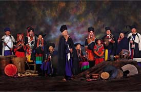
There was no written law for the Yis in the Liangshan Mountains, but there was an unwritten customary law which was almost the same in various places. Apart from certain remnants of the customary law of clan society, this customary law reflected the characteristics of morality and the social rank system. It explicitly upheld the rank privileges and ruling position of the black Yis, claiming that the rule of slave owners was a "perfectly justified principle." The legal viewpoint of the customary law was clear-cut. Any personal attacks against black Yis, encroachment on their private property, violation of the marriage system of the rank and infringement on the privileges of the black Yis were regarded as "crimes," and the offenders would be severely punished.
In most Yi areas, maize, buckwheat, oat and potato were staples. Rice production was limited. Most poor Yi peasants lived on acorns, banana roots, celery, flowers and wild herbs all the year round. Salt was scarce. In the Yi areas, potatoes cooked in plain water, pickled leaf soup, buckwheat bread and cornmeal were considered good foods, which only the well-to-to Yis could afford. At festivals, boiled meat with salt was the best food, which only slave-owners could enjoy.
Cooking utensils of a distinct ethnic color, made of wood or leather, have been preserved in some of the Yi areas. Tubs, plates, bowls and cups, hollowed out of blocks of wood, are painted in three colors- black, red and yellow- inside and outside, and with patterns of thunderclouds, water waves, bull eyes and horse teeth. Wine cups are hollowed out of horns or hoofs.
Yugur (Chinese: 裕固族; Pinyin: Yùgù Zú)
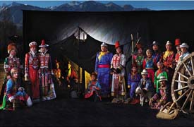
Nearly 90 per cent of the Yugur people live in the Sunan Yugur Autonomous County, and the rest in Huangnibao area near the city of Jiuquan in western Gansu Province.
Due to historical reasons, this ethnic minority uses three languages: a Turkic branch of the Altaic language family (Raohul) used by the Yugurs in the western part of the autonomous county; a Mongolian branch of the same language family (Engle) by those in the eastern part of the county; and the Chinese language by those in Huangnibao. Chinese is also a common medium of communication among all Yugurs.
The Yugur ethnic minority can trace its origins to the nomadic ancient Ouigurs in the Erhun River valley during the Tang Dynasty (618- 907). In the mid- 9th century, the ancient Ouigurs, beset by snowstorms, feuding within the ruling group and attacks from the Turkic Kirgiz, had to move westward in separate groups. One of the groups emigrated to Guazhou (present-day Dunhuang), Ganzhou (present-day Zhangye) and Liangzhou (present-day Wuwei) in the Hexi Corridor- the most fertile area in central-western Gansu Province- and came under the rule of Tubo, a Tibetan kingdom. They were thus called the Hexi Ouigurs. Later, they captured the city of Ganzhou and set up a khanate- thus they were also called Ganzhou Ouigurs.
The Hexi Ouigurs had all along maintained very close ties with the central empire and regarded these ties as relations of "nephew to uncle." During the Northern Song Dynasty (960- 1126), the Khan of the Ganzhou Ouigurs often sent special envoys to the imperial capital to present tribute to the emperor, and, in return, the Song court gave "the nephew Ouigur Khan in Ganzhou" special products from central China. The Khan's emissaries went to the capital of the Song Dynasty on several missions to offer camels, horses, coral and amber as tribute to the imperial court in the fifth year (980) of the reign of Emperor Taizong and the third year (1010) of the reign of Emperor Zhenzong.
In the mid-11th century, the Western Xia Kingdom conquered Ganzhou and toppled the Ouigur regime. The Hexi Ouigurs then became dependants of the former and moved to pastoral areas outside the Jiayu Pass. However, their links with the Song court were still maintained. Ouigur envoys came to the Song capital with tribute again during the first year of the reign of Emperor Shenzong (1068) and requested a copy of a Buddhist scripture. According to an envoy in 1073, there were more than 300,000 Ouigurs at that time. In 1227 the Mongols conquered Western Xia Kingdom and put the Hexi Ouigurs under their direct rule.
Part of the Hexi Ouigurs were assimilated with neighboring ethnic groups over a long period of co-existence from the mid-11th to the 16th century, and developed into a community -- the present-day Yugurs. They lived around Dunhuang in western Gansu and Hami in eastern Xinjiang.
The Ming (1368- 1644) rulers moved many of the Yugurs farther east as the frontier became unsettled.
The Yugurs underwent changes in the mode of economic production after their eastward move. Those in the Huangnibao area, availing themselves of exchanges with the Hans, learned farming and gradually substituted it for animal husbandry, while those in the Sunan area still engaged in livestock breeding and hunting. Thanks to the introduction of iron implements from the Hans, the Yugur peoples' skills in farming, animal husbandry and hunting all improved.
The Qing government (1644- 1911), in an attempt to strengthen its rule, divided the Yugurs into "seven tribes" and appointed a headman for each and a powerful chieftain- the "Huangfan Superintendent of the Seven Tribes"- over them all.
The Qing government made it a law for the Yugur tribes to offer 113 horses every year in exchange for tea. At first, they got some tea, but later, virtually none. The horses thus contributed were tribute pure and simple. The tribute demanded by the central government also included stag antlers, musk and furs. The Suzhou Yugurs had to deliver grain or silver.
Lamaism began to get the upper hand in the Yugur area in the Ming and Qing dynasties. Each tribe had its own monastery. The lamas worked closely with the chiefs in important tribal matters; some tribes practiced integration of religion and politics. The Lamaist monasteries had their own feudal system of oppression and exploitation: courts, prisons and instruments of torture. They could order compulsory donations and gratuitous forced labor, and compel children to join the clergy. Some lamas extorted large amounts of money and property out of the common people by way of fortune telling and exorcism. Donations for religious purposes accounted approximately for 30 per cent of the annual income of a middle-class family.
All these hardships reduced the ethnic group virtually to extinction. At the time of the mid-20century, its population was less than 3,000.
In February and April of 1954, the Sunan Yugur Autonomous County
and Jiuquan Huangnibao Yugur Autonomous Township were established. This development ushered in a new period of cultural progress and economic growth among the Yugur people.
The Yugurs have a rich literary tradition handed down orally, such as legends, folk tales, proverbs and ballads. The folk songs feature uniquely simple yet graceful tunes, and vivid content.
They are skilled at the plastic arts, weaving beautiful patterns on bags, carpets and harnesses. Vivid patterns in harmonious colors of flowers, grass, insects, birds and domestic animals are woven on women's collars, sleeves and cloth boots. Geometrical patterns made of coral beads, sea shells and green and blue stone chips, and silk threads in bright colors are used as hair decorations.
Zhuang (Chinese: 壮族; Pinyin: Zhuàng Zú)
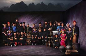
The Zhuangs ethnic minority is China's largest minority group. Its population of 15.55 million approaches that of Australia. Most of the Zhuangs live in southwest China's Guangxi Zhuang Autonomous Region, which is nearly the size of New Zealand. The rest have settled in Yunnan, Guangdong, Guizhou and Hunan provinces.
While most Zhuang communities concentrate in a compact area in Guangxi, the others are scattered over places shared by other ethnic groups such as Han, Yao, Miao, Dong, Mulao, Maonan and Shui.
Lying in Guangxi's mountainous regions, the Zhuang area is high in the northwest, undulating in the middle and low in the southeast. Limestone is widely distributed in the area, which is known round the world for its karst topography. Many rocky peaks rise straight up from the ground, and the peaks hide numerous fascinating grottoes and subterranean rivers. Guilin, a tourist attraction in Guangxi, is an excellent example of such landscape. As the saying goes: "The landscape at Guilin is the best on earth; and the landscape at Yangshuo is the best in Guilin." Wuming, Jingxi and Lingyun counties are also known for their scenic splendors.
Crisscrossing rivers endow the Zhuang area with plentiful sources of water for irrigation, navigation and hydropower. The coastline in south Guangxi not only has important ports but also yields many valuable marine products including the best pearls in China.
The Zhuang area enjoys a mild climate with an average annual temperature of 20 degrees centigrade, being warm in winter and sweltering in summer in the south. Plants are always green, blossoming in all seasons. Abundant rainfall nurtures tropical and subtropical crops such as rice, yam, corn, sugar cane, banana, longan, litchi, pineapple, shaddock and mango. The mountains in southwest and northwest Guangxi abound in Liuzhou fir, silver fir and camphor trees, rare elsewhere. Mineral resources include iron, coal, wolfram, gold, copper, tin, manganese, aluminum, stibium, zinc and petroleum. The area is also rich in tung oil, tea, tea oil, mushroom, Chinese cinnamon, pseudo-ginseng, Chinese gecko (used in traditional Chinese medicine to help regain vitality), fennel and fennel essence. The last four items are the Zhuang area's special products.
"Zhuang" was one of the names the ancestors of the ethnic group gave themselves. The term was first recorded some 1,000 years ago, in the Song Dynasty. The Zhuangs used to call themselves by at least a dozen other names, too.
The Zhuang areas first came under the administration of China's central authority 2,000 years ago. In 221 BCE, the First Emperor of Qin, China's first emperor to unify the country, conquered the area and established three prefectures there. The emperor had the Lingqu Canal built to facilitate irrigation. He also started a project to move people from other places to the area, strengthening its political, economic and cultural ties with the central-south part of the country.
In the centuries that followed, a number of powerful clans emerged in this area, who owned vast tracts of land and numerous slaves and servants. Still later, during the Tang and Song dynasties, social and economic development was such that irrigated rice paddies, farm cattle, iron, copper and spinning and weaving spread far and wide.
However, the Zhuang area still lagged behind central China economically. Quite a number of places retained the primitive mode of production, including slash-and-burn cultivation and hunting. The dominant social system was feudal serfdom and people were classified into three strata: hereditary landowners, tenant farmers and house slaves. The system was eliminated during the Qing Dynasty (1644- 1911), the last feudal monarchy in China.
Administratively, most of the Zhuang area was governed by the headmen system all through the over 1,000 years from the Tang to Qing dynasties. Backed by the central authorities, the local headmen oppressed and exploited the Zhuangs, forcing them into hundreds of uprisings.
In 1851, the Taiping Rebellion, the largest peasant uprising in Chinese history, broke out in this area. Thousands of Zhuangs joined the Taiping Army, forming its spine in its march to the north. Many of them became important leaders of the army and the Heavenly Kingdom of Taiping.
Inhabiting China's southern frontier areas, the Zhuangs have played an important role in defending the country's territory. In the 1070s, they repulsed the Annamese aggressors; in the middle 16th century, they beat back the invading Japanese pirates.
Towards the end of the 19th century, French troops that had occupied South Vietnam pushed northward and invaded China. People of Zhuang and Han nationalities in Guangxi formed the Black Banner Army and trounced the French invaders near Hanoi in 1873. They again routed the French at Hanoi in 1882.
When the French invaders made new incursions into China in 1885, the local Zhuang and Han people helped the Chinese army win a crucial victory at Zhennanguan, a pass on the Sino-Vietnamese border.
The Zhuangs also made great contributions to the Revolution of 1911, China's first democratic revolution led by Dr. Sun Yat-sen. Many Zhuangs became key members of the Tong Meng Hui, an organization Dr. Sun formed to advance his revolutionary cause.
The Zhuang language belongs to the Chinese-Tibetan language family. Ancient Zhuang characters appeared in the South Song Dynasty (1127- 1279), but never got popularized. So, the Zhuangs wrote in the Han script until 1955, when the central government helped them create a writing system based on the Latin alphabet. The Romanized script has been used in books, magazines and newspapers.
The Zhuang ethnic group's ancient culture and art are not only rich and colorful but also outstanding with their indigenous characteristics. For example, 2,000-year-old frescoes have been found at more than 50 spots on the precipices hanging over the Zuojiang River running through southwest Guangxi. The best known of them is the Huashan fresco in Ningming County which is over 100 meters long and 40 meters wide, featuring 1,300 figures. Drawn in rugged and vigorous lines, it reflects the life of the Zhuangs' ancestors.
Bronze drum, a special relic of minority groups in central south and southwest China, dates back well over two millennia. Guangxi alone has unearthed more than 500 of such drums, which are in different designs and sizes. The largest exceeds one meter in diameter and the heaviest weighs over half a ton while the lightest several dozen kilograms. The tops and sides of the drums are decorated with designs done in relief.
However, explanations are diverse in so far as the use of these drums is concerned. Some people believe that they were meant for military music, others argue that they were for folk music, and still others think they were for religious rites or to symbolize power and wealth.
Zhuang brocade is a splendid handicraft which originated in the Tang Dynasty (618- 907). Woven in beautiful designs with natural cotton warp and dyed velour weft, the brocade is excellent for making quilt covers, table-clothes, braces, aprons and handbags. Winning national fame during the Ming and Qing dynasties (1368- 1911), Zhuang brocade has been steadily improved and at least 40 new designs have been developed in the past few decades.
Legends, fairy tales, stories and ballads frame the folk literature of the Zhuangs who have also been reputed for their singing. Sweet songs can be heard wherever you go in the Zhuang area. Extemporaneous melodies and lyrics and clever use of metaphors, riddles and cross-examinations add charm to their songs. It is said that, in the Tang Dynasty, a Zhuang woman singer called Third Sister Liu became known not just for her beautiful singing but especially for the courageous exposure in her songs of the crudeness of local tyrants. Today her name is a household word throughout China thanks to a successful film about her made in the 1950s.
In the old days, every Zhuang community held its regular songfests at given venues. On those occasions, young people from nearby villages would come together in their holiday best to meet each other and choose their lovers through songs.
Common Zhuang musical instruments include suona (Chinese cornet), bronze drum, cymbal, gong, sheng (Chinese wind pipe), xiao (vertical bamboo flute), di (Chinese flute) and huqin (a stringed instrument) made of horse bones.
Zhuang dances are characterized by distinct themes, forceful and nimble steps, jocular and humorous gestures and true-to-life emotions. The Rice-Husking Dance, Silk-Ball Dance, Shrimp-Catching Dance, Tea-Picking Dance, Shoulder-Pole Dance and Bronze-Drum Dance not only vividly depict the Zhuangs' life and work, but also display their straightforward, unbending nature.
Yet what combines the Zhuangs' folk literature, music, dance and other forms of art is the Zhuang Opera, which first originated from religious rites in the Tang Dynasty.
![]()